MyTopo
Peculiar Missouri US Topo Map
Couldn't load pickup availability
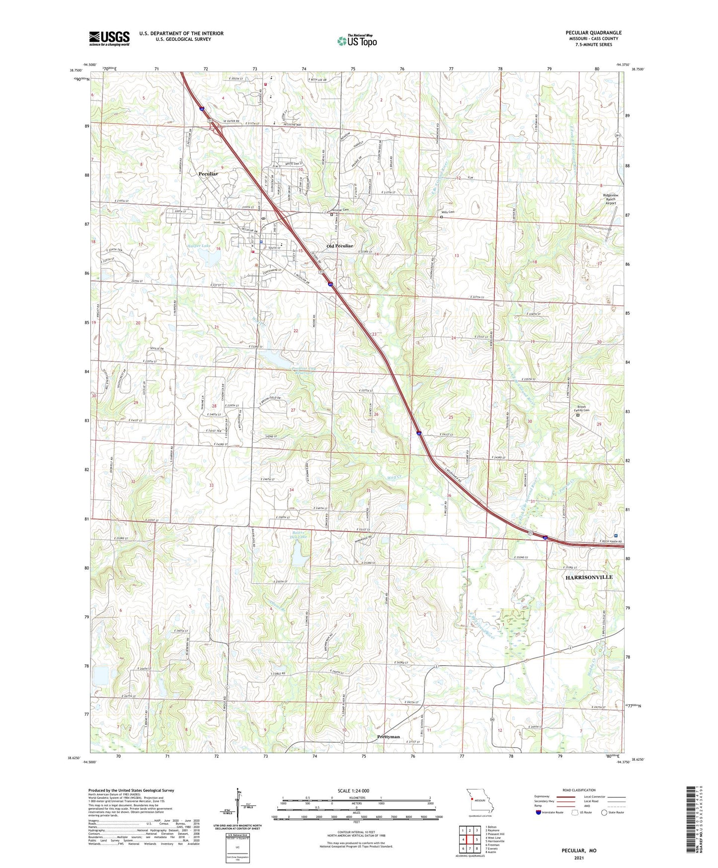
2021 topographic map quadrangle Peculiar in the state of Missouri. Scale: 1:24000. Based on the newly updated USGS 7.5' US Topo map series, this map is in the following counties: Cass. The map contains contour data, water features, and other items you are used to seeing on USGS maps, but also has updated roads and other features. This is the next generation of topographic maps. Printed on high-quality waterproof paper with UV fade-resistant inks.
Quads adjacent to this one:
West: West Line
Northwest: Belton
North: Raymore
Northeast: Pleasant Hill
East: Harrisonville
Southeast: Austin
South: Everett
Southwest: Freeman
This map covers the same area as the classic USGS quad with code o38094f4.
Contains the following named places: Baiers Den Lake, Baiers Den Lake Dam, Barton, Bills School, Brown Family Cemetery, Brush College School, Cass Regional Medical Center, City of Peculiar, East Fork East Branch South Grand River, Harper Lake, Harper Lake Dam, Muddy Creek, Old Peculiar, Peculiar, Peculiar Cemetery, Peculiar City Reservoir, Peculiar City Reservoir Dam, Peculiar Elementary School, Peculiar Police Department, Peculiar Post Office, Pleasant Ridge School, Polecat Creek, Prettyman, Raymore - Peculiar Freshman Center, Raymore - Peculiar High School, Raymore - Peculiar Middle School, Ridgeview Ranch Airport, Rockford School, Rodman School, Shull Elementary School, South Harper Peaking Facility, Township of West Peculiar, West Aero Ranch Airport, West Peculiar Fire Protection District Station 1, Wills Cemetery, Wolf Creek, Wolfe School, ZIP Code: 64078