MyTopo
Berlin Missouri US Topo Map
Couldn't load pickup availability
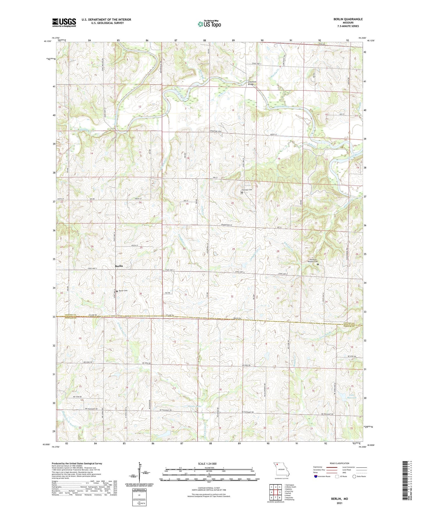
2021 topographic map quadrangle Berlin in the state of Missouri. Scale: 1:24000. Based on the newly updated USGS 7.5' US Topo map series, this map is in the following counties: Gentry, DeKalb. The map contains contour data, water features, and other items you are used to seeing on USGS maps, but also has updated roads and other features. This is the next generation of topographic maps. Printed on high-quality waterproof paper with UV fade-resistant inks.
Quads adjacent to this one:
West: Ford City
Northwest: Darlington
North: Albany South
Northeast: Matkins
East: McFall
Southeast: Weatherby
South: Maysville
Southwest: Wood
Contains the following named places: Andy Denton Public Access, Beach Branch, Berlin, Berlin Cemetery, Brushy Creek, Campbell Creek, Concord School, Crawford Bridge, Elam Bend State Wildlife Area, Elsworth School, Grandview School, Grindstone-Lost-Muddy Creek Watershed Dam D-22, Grindstone-Lost-Muddy Creek Watershed Dam D-23, Hickory Creek, Jestes Lake, Jestes Lake Dam, Jolly Creek, Lake Mar-Lou, Limestone School, Nance Dam, Oak Grove School, Osborne Bridge, Rattlesnake School, Red Star School, Township of Miller, Wheeler Creek