MyTopo
Weatherby Missouri US Topo Map
Couldn't load pickup availability
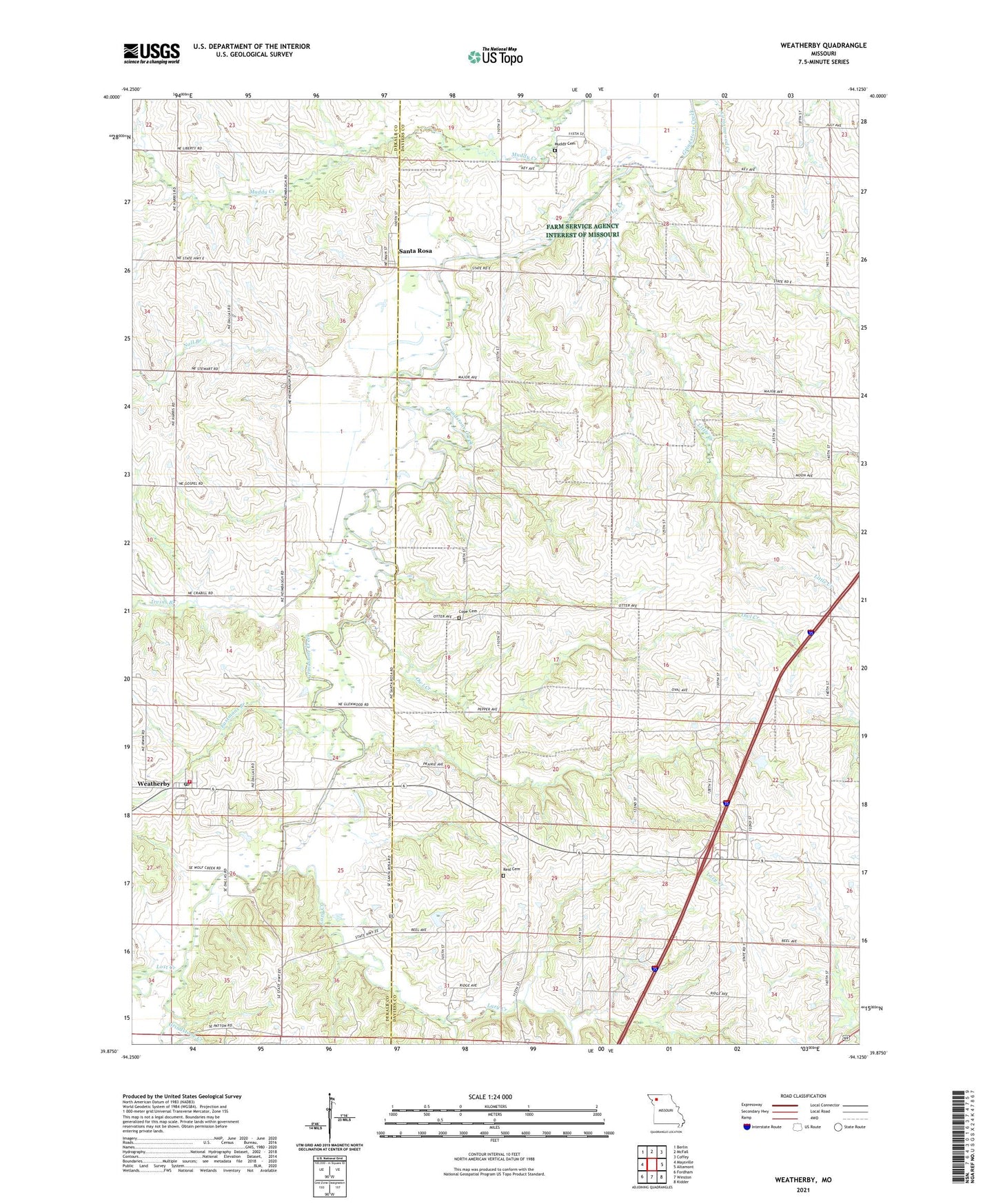
2021 topographic map quadrangle Weatherby in the state of Missouri. Scale: 1:24000. Based on the newly updated USGS 7.5' US Topo map series, this map is in the following counties: Daviess, DeKalb. The map contains contour data, water features, and other items you are used to seeing on USGS maps, but also has updated roads and other features. This is the next generation of topographic maps. Printed on high-quality waterproof paper with UV fade-resistant inks.
Quads adjacent to this one:
West: Maysville
Northwest: Berlin
North: McFall
Northeast: Coffey
East: Altamont
Southeast: Kidder
South: Winston
Southwest: Fordham
This map covers the same area as the classic USGS quad with code o39094h2.
Contains the following named places: Alta Vista, Alta Vista Church, Alta Vista School, Brownsdale, Brownsdale Post Office, Center Point School, Central Dekalb County Fire Protection District Weatherby, Cope Cemetery, Cottonwood Creek, Crabill School, Eastmans Branch, Fairview Church, Fairview School, Grindstone-Lost Muddy Creek Watershed Dam F-30, Grindstone-Lost-Muddy Creek Watershed Dam F-20, Grindstone-Lost-Muddy Creek Watershed Dam F-32, Irvins Branch, Lazy Creek, Little Creek, Lost Creek, Mc Culley School, Muddy Cemetery - West, New Hope Church, New Salem Church, Noll Branch, Oak Grove School, Oak Ridge School, Owl Creek, Reid Cemetery, Santa Rosa, Smith Branch, Spring Hill School, Town of Weatherby, Township of Jefferson, Victoria School, Weatherby, Weatherby Post Office, ZIP Code: 64497