MyTopo
Albany South Missouri US Topo Map
Couldn't load pickup availability
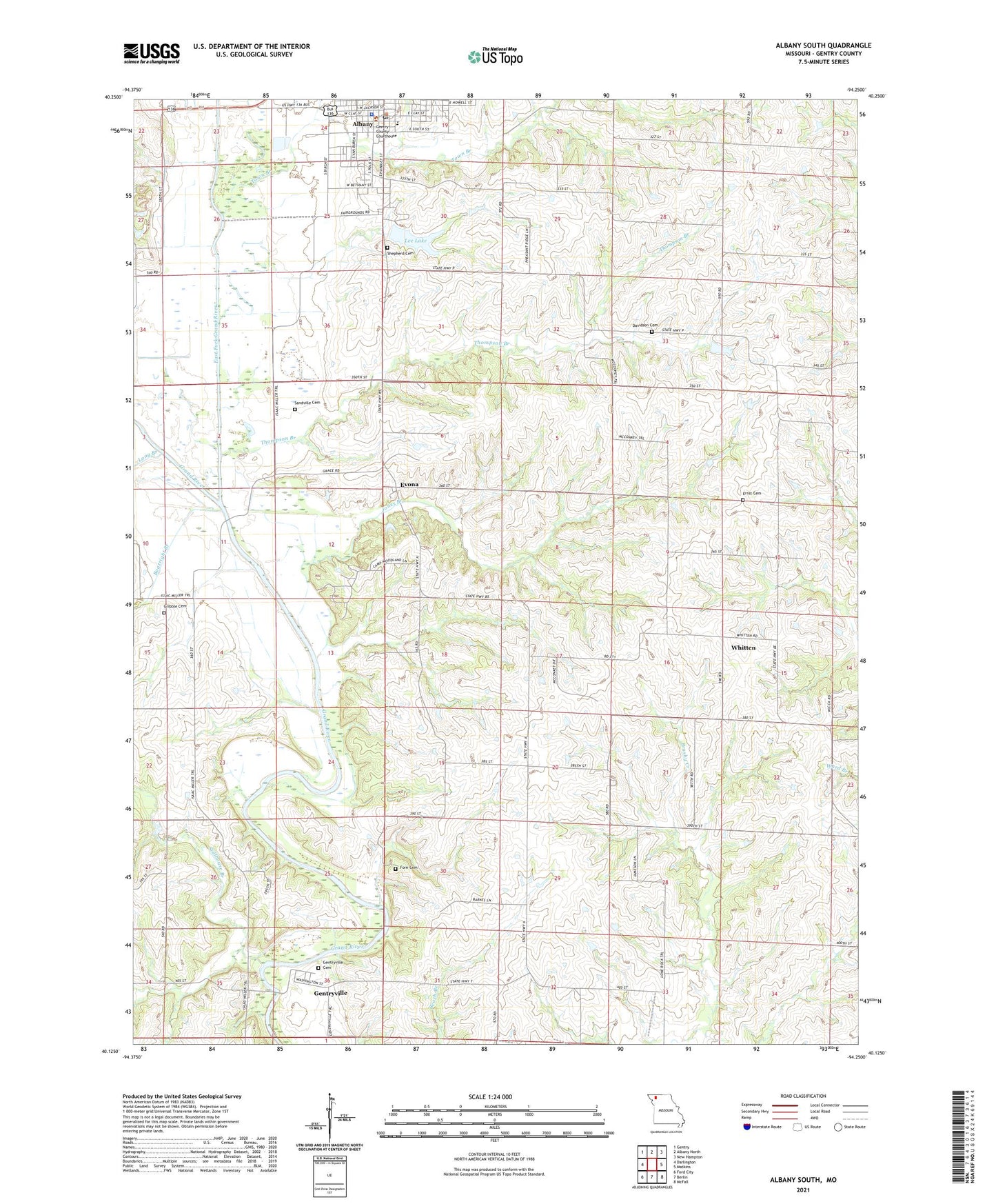
2021 topographic map quadrangle Albany South in the state of Missouri. Scale: 1:24000. Based on the newly updated USGS 7.5' US Topo map series, this map is in the following counties: Gentry. The map contains contour data, water features, and other items you are used to seeing on USGS maps, but also has updated roads and other features. This is the next generation of topographic maps. Printed on high-quality waterproof paper with UV fade-resistant inks.
Quads adjacent to this one:
West: Darlington
Northwest: Gentry
North: Albany North
Northeast: New Hampton
East: Matkins
Southeast: McFall
South: Berlin
Southwest: Ford City
This map covers the same area as the classic USGS quad with code o40094b3.
Contains the following named places: Albany, Albany Junction, Albany Post Office, Boatright Branch, City of Albany, Curt Lee Dam, Davidson Cemetery, East Fork Grand River, Effingham, Ernst Cemetery, Eureka School, Evona, Evona School, Fore Cemetery, Fore School, Gartin School, Gentry County Sheriff's Office, Gentryville, Gentryville School, Gribble Cemetery, Jones Branch, Lee Lake, Lone Rock School, Long Branch, Mount Zion Church, Sandville Cemetery, Sandville School, Shepherd Cemetery, Spessard School, Stillhouse Branch, Thompson Branch, Town Branch, Township of Athens, Virginia E George Elementary School, Whitten