MyTopo
Wood Missouri US Topo Map
Couldn't load pickup availability
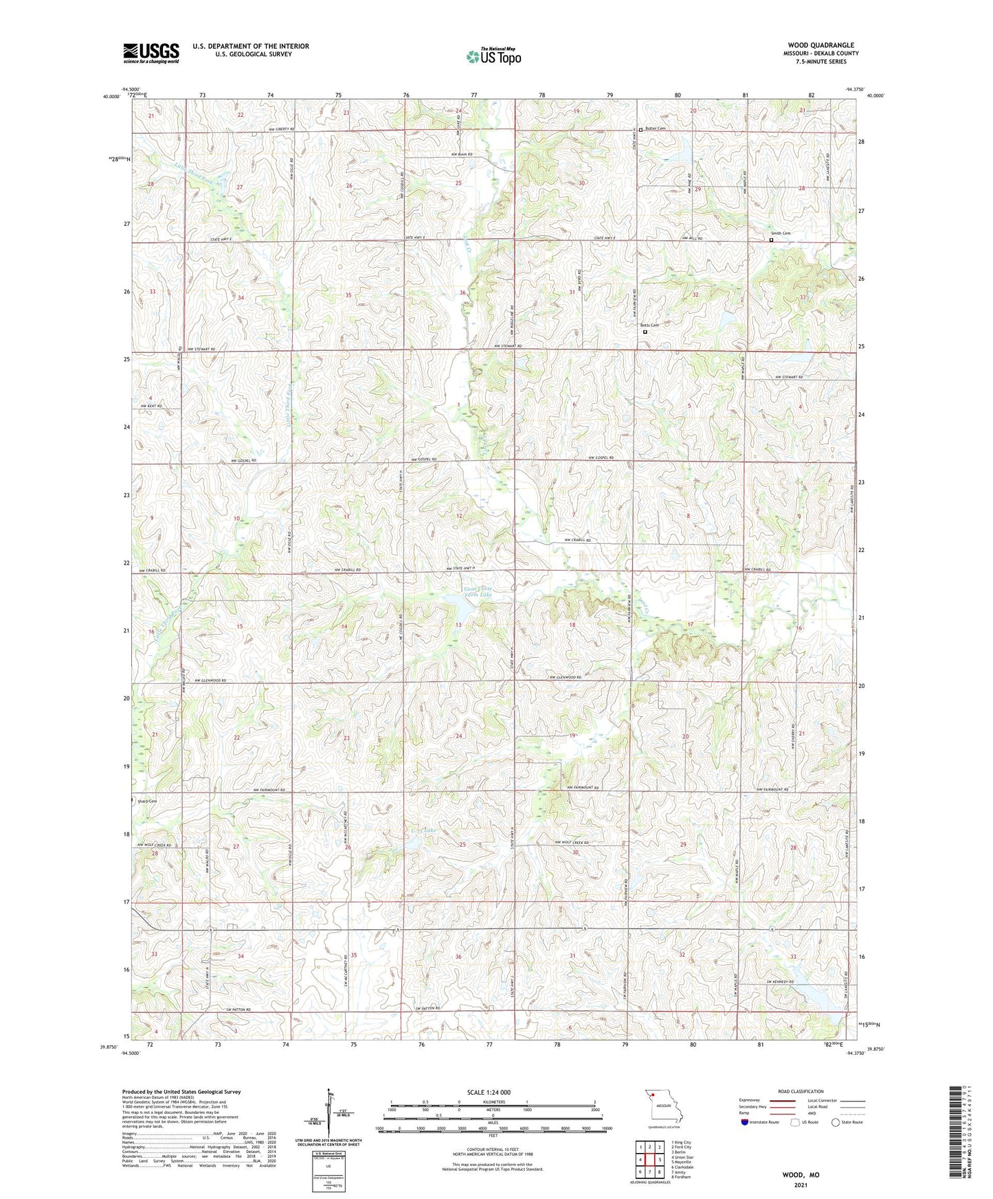
2021 topographic map quadrangle Wood in the state of Missouri. Scale: 1:24000. Based on the newly updated USGS 7.5' US Topo map series, this map is in the following counties: DeKalb. The map contains contour data, water features, and other items you are used to seeing on USGS maps, but also has updated roads and other features. This is the next generation of topographic maps. Printed on high-quality waterproof paper with UV fade-resistant inks.
Quads adjacent to this one:
West: Union Star
Northwest: King City
North: Ford City
Northeast: Berlin
East: Maysville
Southeast: Fordham
South: Amity
Southwest: Clarksdale
This map covers the same area as the classic USGS quad with code o39094h4.
Contains the following named places: Botts Cemetery, Butler Cemetery, C-75 Lake, DeKalb County, Fairmount School, Faith Chapel, Gene Carte Farm Lake, Glenkirk Farms Lake Dam, Grindstone-Lost-Muddy Creek Watershed Dam B-6, Grindstone-Lost-Muddy Creek Watershed Dam C-5, Grindstone-Lost-Muddy Creek Watershed Dam C-75, Grindstone-Lost-Muddy Creek Watershed Dam D-31, Grindstone-Lost-Muddy Creek Watershed Dam D-34, Grindstone-Lost-Muddy Creek Watershed Dam D-42, Liberty School, Maple Grove School, Maysville New Reservoir Dam, Maysville Reservoir, Mount Hope School, Ogle School, Roberts School, Sandy Hook Creek, Smith Cemetery, Township of Camden, Township of Grant, Universal School, Waldo School, Wood, Wood School, ZIP Code: 64422