MyTopo
Berryman Missouri US Topo Map
Couldn't load pickup availability
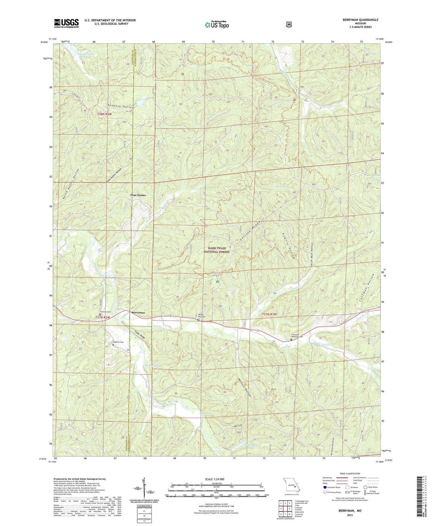
2021 topographic map quadrangle Berryman in the state of Missouri. Scale: 1:24000. Based on the newly updated USGS 7.5' US Topo map series, this map is in the following counties: Washington, Crawford. The map contains contour data, water features, and other items you are used to seeing on USGS maps, but also has updated roads and other features. This is the next generation of topographic maps. Printed on high-quality waterproof paper with UV fade-resistant inks.
Quads adjacent to this one:
West: Huzzah
Northwest: Onondaga Cave
North: Anthonies Mill
Northeast: Ebo
East: Shirley
Southeast: Palmer
South: Courtois
Southwest: Davisville
Contains the following named places: Bass Ranch, Berryman, Berryman Campground, Berryman School, Berryman Trail, Billys Branch, Brazil Creek Campground, C D Smiths Sawmill, Cedar Ridge, Clear Creek, Coffman Hollow, Courtois Cemetery, Courtois Church, Cresswell - Matthews Cemetery, Dans Branch, Davis Sawmill, Dobkins Cemetery, Edward Beecher Recreation Area, Flagg Branch, Four Points, Harmon Spring Campground, Harveys Sawmill, Henpeck Hollow Dam, Johns Creek, Kemlin Hollow, Levey School, Little Lost Creek, Lost Creek, Machell Hollow, Matthews Lead Mine, Oak Grove Church, Picayune Lead Diggings, Pine Forest School, Shirley Ridge, Smith Mill Hollow, Thunder Valley Farm Dam, Thunder Valley Farm Lake, Timberlane Lake, Timberlane Lake Dam, Usury Lead Mine, Wheelings Lead Mines and Furnace, Whitby - Ellis Cemetery, Woods Lake