MyTopo
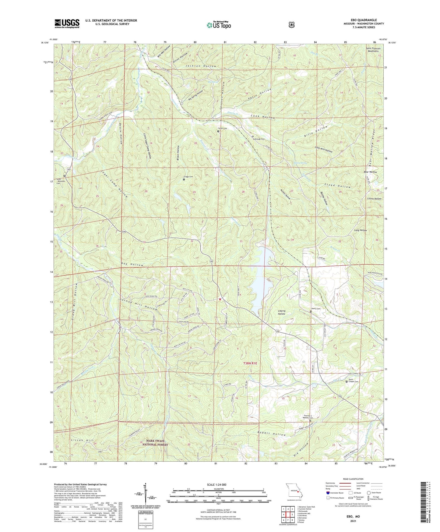
Ebo Missouri US Topo Map
Couldn't load pickup availability
Also explore the Ebo Forest Service Topo of this same quad for updated USFS data
2023 topographic map quadrangle Ebo in the state of Missouri. Scale: 1:24000. Based on the newly updated USGS 7.5' US Topo map series, this map is in the following counties: Washington. The map contains contour data, water features, and other items you are used to seeing on USGS maps, but also has updated roads and other features. This is the next generation of topographic maps. Printed on high-quality waterproof paper with UV fade-resistant inks.
Quads adjacent to this one:
West: Anthonies Mill
Northwest: Meramec State Park
North: Cyclone Hollow
Northeast: Richwoods
East: Old Mines
Southeast: Potosi
South: Shirley
Southwest: Berryman
This map covers the same area as the classic USGS quad with code o38090a8.
Contains the following named places: Bainey Hollow, Bainey Spring, Baughers Sawmill, Bean and Caseys Sawmill, Bear Wallow, Bear Wallow Ridge, Bessie Hollow, Big Spring, Big Spring Hollow, Billy Hollow, Brown Hollow, Brushy Fork, Conk Hollow, Day Hollow, Dry Hollow, Ebo, Flowing Well, Floyd Hollow, Fourche a Renault, Fourche a Renault Cemetery, Fourche a Renault Church, Goose Creek, Goose Creek School, Grady Mill Hollow, Griggs Cemetery, Hipointe Tower State Public Hunting Area, Indian Creek Mine, Indian Creek Mine Lower Dam, Indian Creek Mine Tailings Pond, Indian Creek Mine Upper Dam, Jackson Hollow, John Flynns Sawmill, Joshua Hill Hollow, Liberty Cemetery, Liberty Church, Lime Kiln Hollow, Little Sugar Camp Hollow, Litton Hill, Maple Grove Church, Northcut, Onion Hollow, Page School, Patton Hollow, Pinery Creek, Potosi Fire Protection District House 5, Rabbit Hollow, Scott - Reynolds Cemetery, Section Hollow, Smith Cemetery, Souls Chapel, Souls Chapel Cemetery, State School for the Handicapped, Sugar Camp Hollow, Township of Liberty, Troutt, Valle Hollow, Watson Creek, Will Wet Hollow, Yarbrough Cemetery