MyTopo
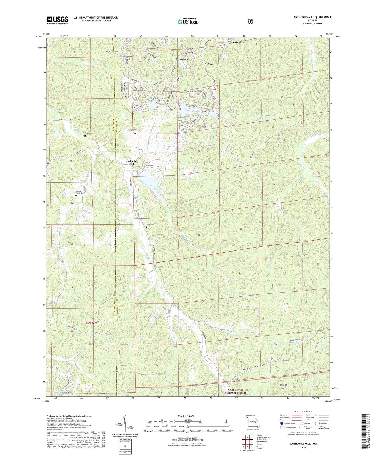
Anthonies Mill Missouri US Topo Map
Couldn't load pickup availability
Also explore the Anthonies Mill Forest Service Topo of this same quad for updated USFS data
2021 topographic map quadrangle Anthonies Mill in the state of Missouri. Scale: 1:24000. Based on the newly updated USGS 7.5' US Topo map series, this map is in the following counties: Washington, Crawford. The map contains contour data, water features, and other items you are used to seeing on USGS maps, but also has updated roads and other features. This is the next generation of topographic maps. Printed on high-quality waterproof paper with UV fade-resistant inks.
Quads adjacent to this one:
West: Onondaga Cave
Northwest: Sullivan
North: Meramec State Park
Northeast: Cyclone Hollow
East: Ebo
Southeast: Shirley
South: Berryman
Southwest: Huzzah
This map covers the same area as the classic USGS quad with code o38091a1.
Contains the following named places: Anthonies Mill, Anthonies Mill Cemetery, Ashley Branch, Brazil Church, Cavernville School, Cicero Creek, Dellistri Dam, Dellistri Lake, Flint Hill, Grant Spring, Greer Hollow, Harris Branch, Hematite Lake Dam, Little Brazil Creek, Metcalf Cemetery, Metcalf School, Northcut Branch, Oak Hill School, Old Christy Mine, Pea Ridge Incorporated Lake Dam, Pleasant Valley School, Record Cemetery, Sullivan Fire Protection District Station 2, Swan Cemetery, Township of Johnson, Weins Lead Diggings, Whites Creek