MyTopo
Bevier North Missouri US Topo Map
Couldn't load pickup availability
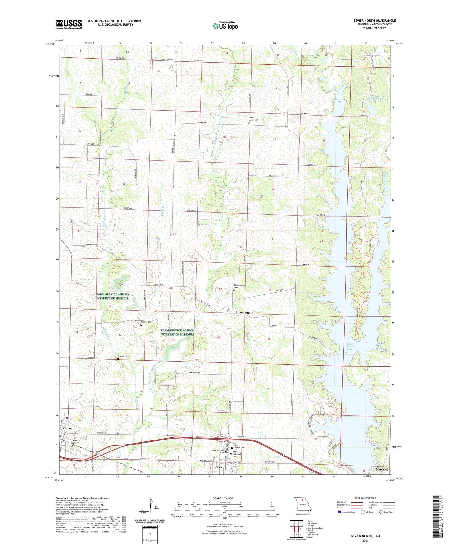
2021 topographic map quadrangle Bevier North in the state of Missouri. Scale: 1:24000. Based on the newly updated USGS 7.5' US Topo map series, this map is in the following counties: Macon. The map contains contour data, water features, and other items you are used to seeing on USGS maps, but also has updated roads and other features. This is the next generation of topographic maps. Printed on high-quality waterproof paper with UV fade-resistant inks.
Quads adjacent to this one:
West: New Cambria East
Northwest: Elmer
North: Barnesville
Northeast: Atlanta
East: Axtell
Southeast: Macon
South: Bevier South
Southwest: Lagonda
Contains the following named places: Bethel Church, Bloomington, Bloomington Cemetery, Callao, Callao Town and Country Fire Department, Camp Branch, Centerville School, City of Bevier, City of Callao, Claude Bloomberg Dam, Claude Bloomberg Lake, East Oakwood Cemetery, Enon Church, Fletcher School, Freedom Cemetery, Hazel Grove School, Lick Creek, Long Branch, Long Branch Dam, Long Branch Lake, Macon County, McVicker Lake Dam, Milam Chapel, Milam Chapel Cemetery, New Fairview School, Old Callao Cemetery, Prairie School, Richards Dale Cemetery, Saint Charles Cemetery, Seney, Seney Post Office, Seny School, Skinner Cemetery, Sweezer Creek, Town Creek, Township of Liberty, Walnut Grove School, West Oakwood Cemetery, ZIP Code: 63532