MyTopo
Elmer Missouri US Topo Map
Couldn't load pickup availability
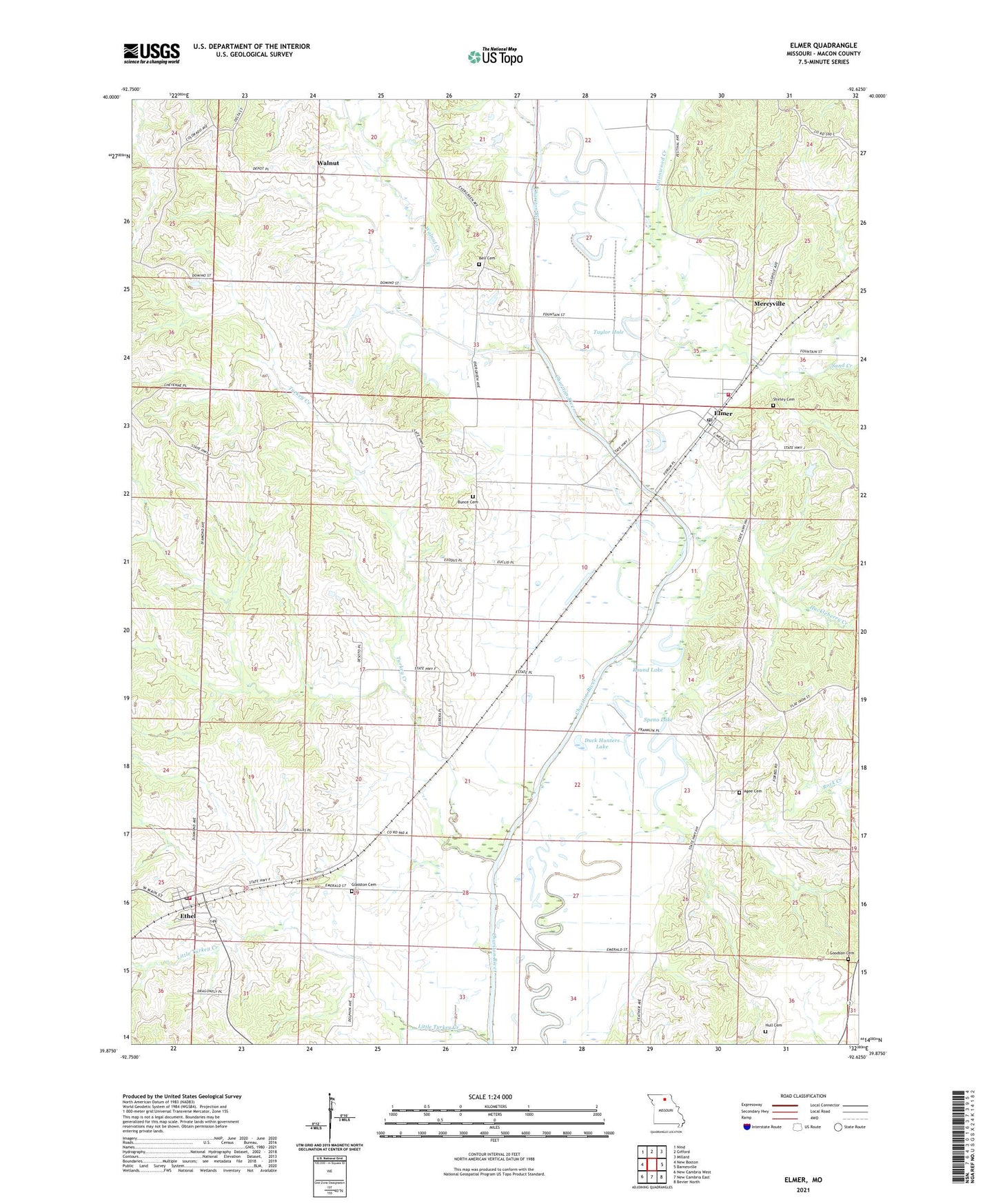
2021 topographic map quadrangle Elmer in the state of Missouri. Scale: 1:24000. Based on the newly updated USGS 7.5' US Topo map series, this map is in the following counties: Macon. The map contains contour data, water features, and other items you are used to seeing on USGS maps, but also has updated roads and other features. This is the next generation of topographic maps. Printed on high-quality waterproof paper with UV fade-resistant inks.
Quads adjacent to this one:
West: New Boston
Northwest: Nind
North: Gifford
Northeast: Millard
East: Barnesville
Southeast: Bevier North
South: New Cambria East
Southwest: New Cambria West
This map covers the same area as the classic USGS quad with code o39092h6.
Contains the following named places: Agee Cemetery, Agee Lake, Bell Cemetery, Bell School, Bone Yard Lake, Bunce Cemetery, Bunce School, City of Elmer, Cottonwood Creek, Diamond School, Duck Hunters Lake, Ellison, Elmer, Elmer Post Office, Elmer Rural Fire Association - Fire Department, Ethel, Ethel Post Office, Ethel Volunteer Fire Department, Fish Lake, Glasston Cemetery, Glasston School, Goff School, Goodson Cemetery, Gunnels Landing Strip, Huckleberry Creek, Hull Cemetery, Little Turkey Creek, Mercyville, Rock Creek, Rock Creek School, Round Lake, Sand Creek, Shirley Cemetery, Speno Lake, Star Store, Taylor Hole, Town of Ethel, Township of Easley, Township of Walnut Creek, Turkey Creek, Walnut, Walnut Creek, ZIP Code: 63538