MyTopo
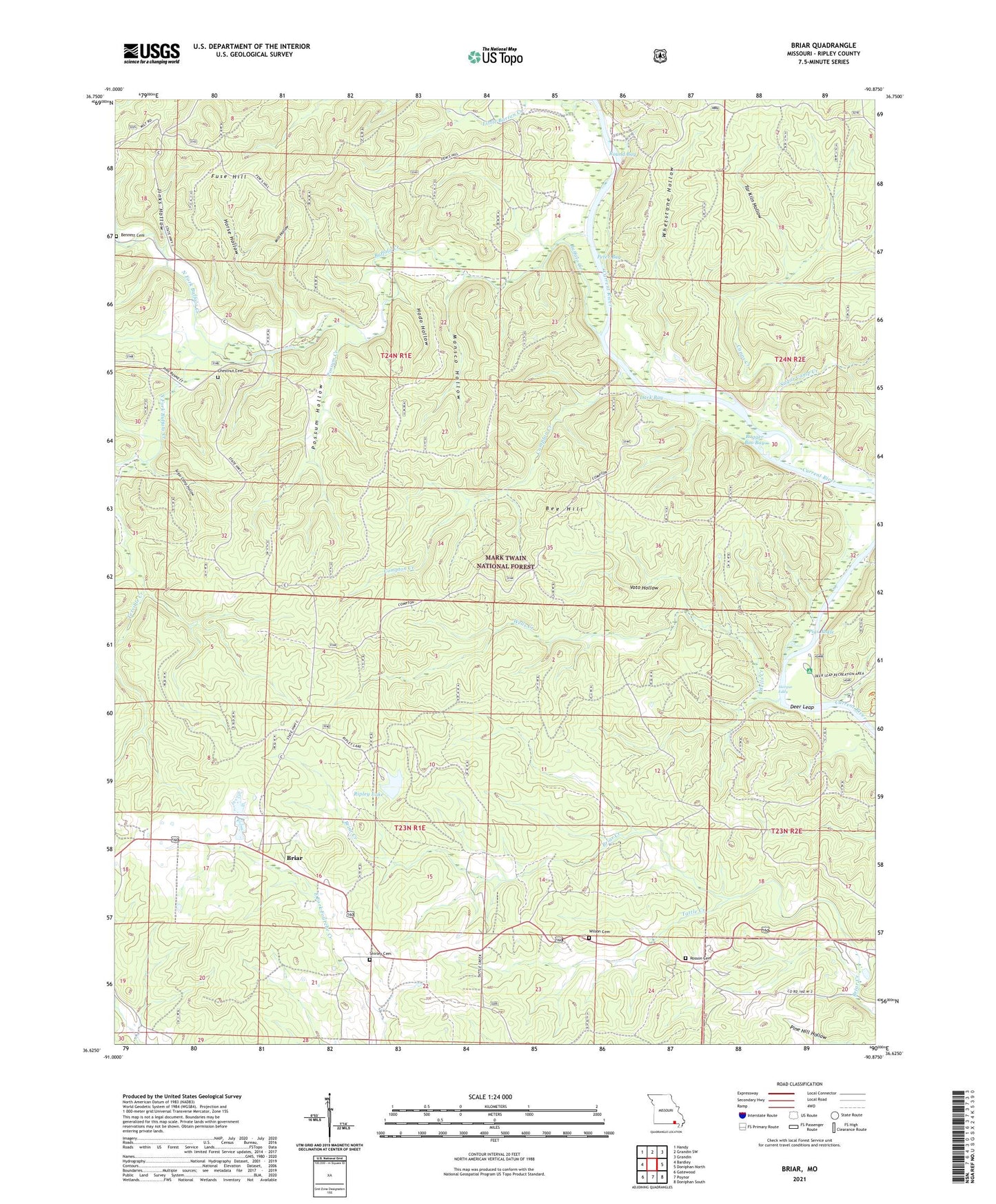
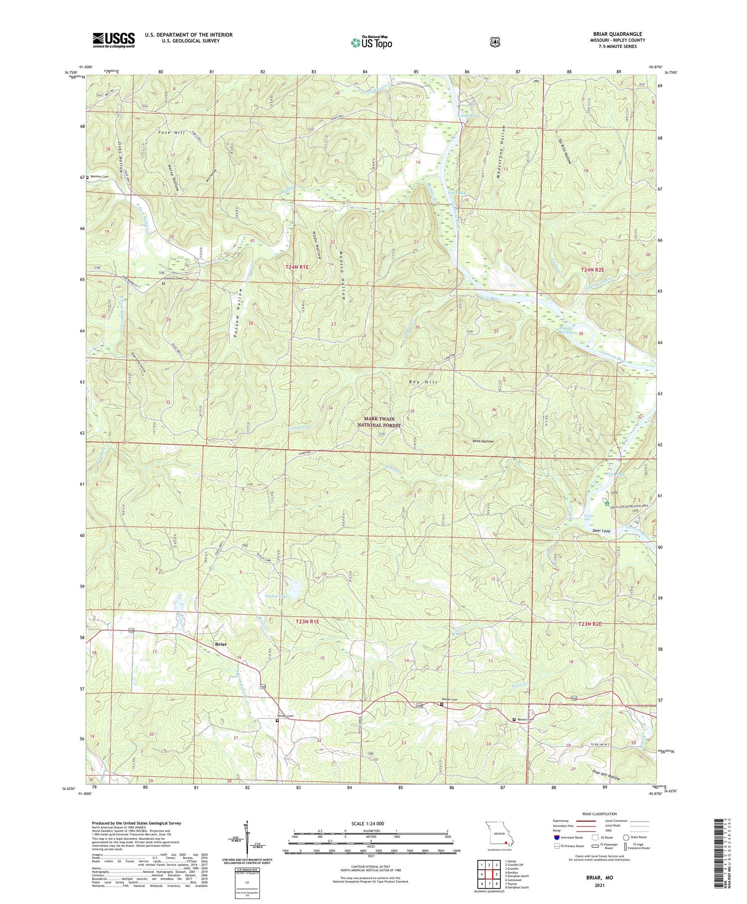
Briar Missouri US Topo Map
Couldn't load pickup availability
2021 topographic map quadrangle Briar in the state of Missouri. Scale: 1:24000. Based on the newly updated USGS 7.5' US Topo map series, this map is in the following counties: Ripley. The map contains contour data, water features, and other items you are used to seeing on USGS maps, but also has updated roads and other features. This is the next generation of topographic maps. Printed on high-quality waterproof paper with UV fade-resistant inks.
Quads adjacent to this one:
West: Bardley
Northwest: Handy
North: Grandin SW
Northeast: Grandin
East: Doniphan North
Southeast: Doniphan South
South: Poynor
Southwest: Gatewood
Contains the following named places: Bee Hill, Bennett Cemetery, Briar, Buffalo Church, Buffalo Club, Buffalo Creek, Buffalo School, Bugger Boo Bay, Capps Creek, Carie, Carie Post Office, Chestnut Cemetery, Compton Creek, Compton Recreation Area, Dark Bay, Deer Leap, Deer Leap Campground, Deer Leap Recreation Area, Fuse Hill, Hargus Eddy, Haws Club, Hodo Hollow, Horse Hollow, Jinks Hollow, Little Barren Creek, Macedonia Lookout, Mansco Hollow, Mill Hollow, North Fork Buffalo Creek, Peter Bay, Pigs Ankle, Pleasant Hill School, Possum Creek, Possum Hollow, Ripley County Lake Dam, Ripley Lake, Ripley Lake Recreation Area, Rosson Cemetery, Round Bay, Shirley Cemetery, Shirley School, Skipper Johnson Club, South Fork Buffalo Creek, Sugar Camp Creek, Sugar Camp Hollow, Tar Kiln Hollow, Tattle Creek, Terrible Creek, Township of Kelley, Township of Shirley, Voto Hollow, Wells Creek, Wells Creek School, Whetstone Hollow, Wilson Cemetery, Wilson Church, Wilson School, ZIP Code: 63935