MyTopo
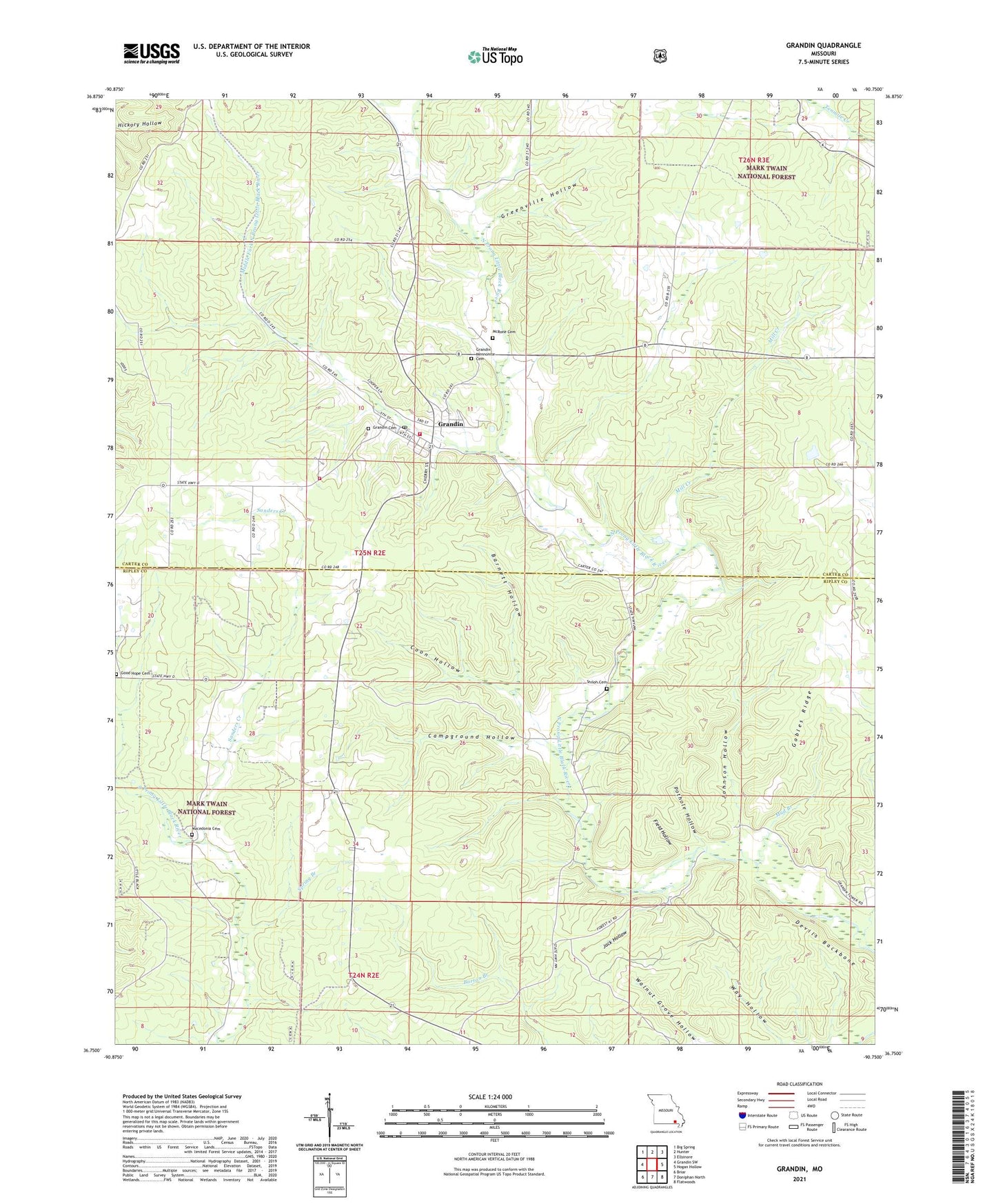
Grandin Missouri US Topo Map
Couldn't load pickup availability
Also explore the Grandin Forest Service Topo of this same quad for updated USFS data
2021 topographic map quadrangle Grandin in the state of Missouri. Scale: 1:24000. Based on the newly updated USGS 7.5' US Topo map series, this map is in the following counties: Carter, Ripley. The map contains contour data, water features, and other items you are used to seeing on USGS maps, but also has updated roads and other features. This is the next generation of topographic maps. Printed on high-quality waterproof paper with UV fade-resistant inks.
Quads adjacent to this one:
West: Grandin SW
Northwest: Big Spring
North: Hunter
Northeast: Ellsinore
East: Hogan Hollow
Southeast: Flatwoods
South: Doniphan North
Southwest: Briar
This map covers the same area as the classic USGS quad with code o36090g7.
Contains the following named places: Barnett Hollow, Camp Semoca, Campground Hollow, Church of Jesus, City of Grandin, Coon Hollow, Crossroads School, Devils Backbone, Field Hollow, Gables Ridge, Good Hope Cemetery, Grandin, Grandin Cemetery, Grandin Fire Department, Greenville Hollow, Jack Hollow, Johnson Hollow, Little Black Rural Fire Department, Macedonia Church, Macedonia School, McRone Cemetery, Middle Fork North Prong Little Black River, Mill Creek, Mud Branch, Oak Grove School, Pothole Hollow, River of Life Church, Saint Anne Church, Sanders Creek, Shiloh Cemetery, Shiloh Church, Shiloh School, Spring Branch, Township of Jordan, Walnut Grove Hollow, Way Hollow, ZIP Code: 63943