MyTopo
Brush Creek Missouri US Topo Map
Couldn't load pickup availability
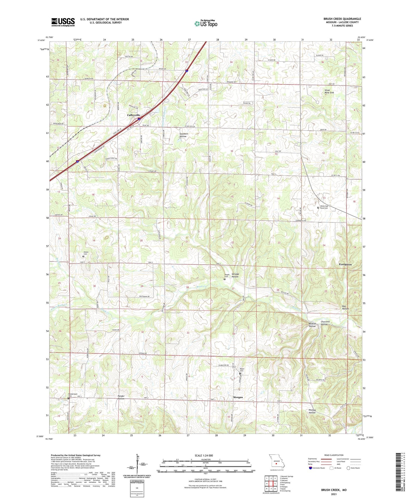
2021 topographic map quadrangle Brush Creek in the state of Missouri. Scale: 1:24000. Based on the newly updated USGS 7.5' US Topo map series, this map is in the following counties: Laclede. The map contains contour data, water features, and other items you are used to seeing on USGS maps, but also has updated roads and other features. This is the next generation of topographic maps. Printed on high-quality waterproof paper with UV fade-resistant inks.
Quads adjacent to this one:
West: Phillipsburg
Northwest: Bennett Springs
North: Lebanon
Northeast: Oakland
East: Russ
Southeast: Grovespring
South: Rader
Southwest: Niangua
Contains the following named places: Bear Thicket Church, Bear Thicket School, Bilderback Cemetery, Brush Creek, Brush Creek Church, Caffeyville, Churchill Hollow, Dog Hollow, Dry and Dusty School, Ecklund Lake Dam, Kissee Cemetery, Lebanon I-44 Speedway, Liberty Church, Morgan, Morgan School, Pisgah Cemetery, Roper Cemetery, Salem Church, Santiago School, Selvage Hollow, Silver Mine Sink, South Fork Brush Creek, Township of Union, Upper Odell School, Washington Church, Washington School, White Oak Pond Cemetery, White Oak Pond Church, Wildcat Hollow