MyTopo
Rader Missouri US Topo Map
Couldn't load pickup availability
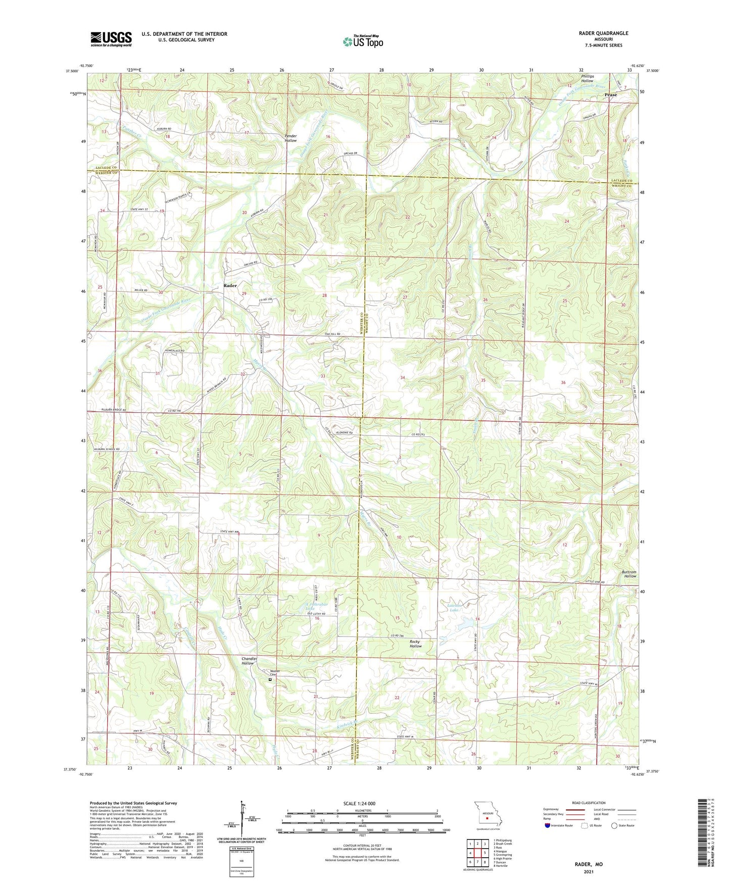
2021 topographic map quadrangle Rader in the state of Missouri. Scale: 1:24000. Based on the newly updated USGS 7.5' US Topo map series, this map is in the following counties: Wright, Webster, Laclede. The map contains contour data, water features, and other items you are used to seeing on USGS maps, but also has updated roads and other features. This is the next generation of topographic maps. Printed on high-quality waterproof paper with UV fade-resistant inks.
Quads adjacent to this one:
West: Niangua
Northwest: Phillipsburg
North: Brush Creek
Northeast: Russ
East: Grovespring
Southeast: Hartville
South: Duncan
Southwest: High Prairie
This map covers the same area as the classic USGS quad with code o37092d6.
Contains the following named places: A J Shrubar Dam, A J Shrubar Lake, Amity Church, Amity School, Chandler Hollow, D and R Lake Lower Dam, D and R Lake Upper Dam, Eureka Church, Eureka School, Happy Home Church, Hyde Creek, Kilburn School, Kindrick Branch, Klondike School, Lawson Lake, Lehar Lake Dam, Little Vine Church, Macedonia Church, Macedonia School, McMahan School, Myers Branch, Oak Grove School, Panther Creek, Pease, Pender Hollow, Phillips Hollow, Pleasant Ridge Church, Pleasant Ridge School, Rader, Smith Branch, Susanna, Weaver Cemetery, ZIP Code: 65713