MyTopo
Grovespring Missouri US Topo Map
Couldn't load pickup availability
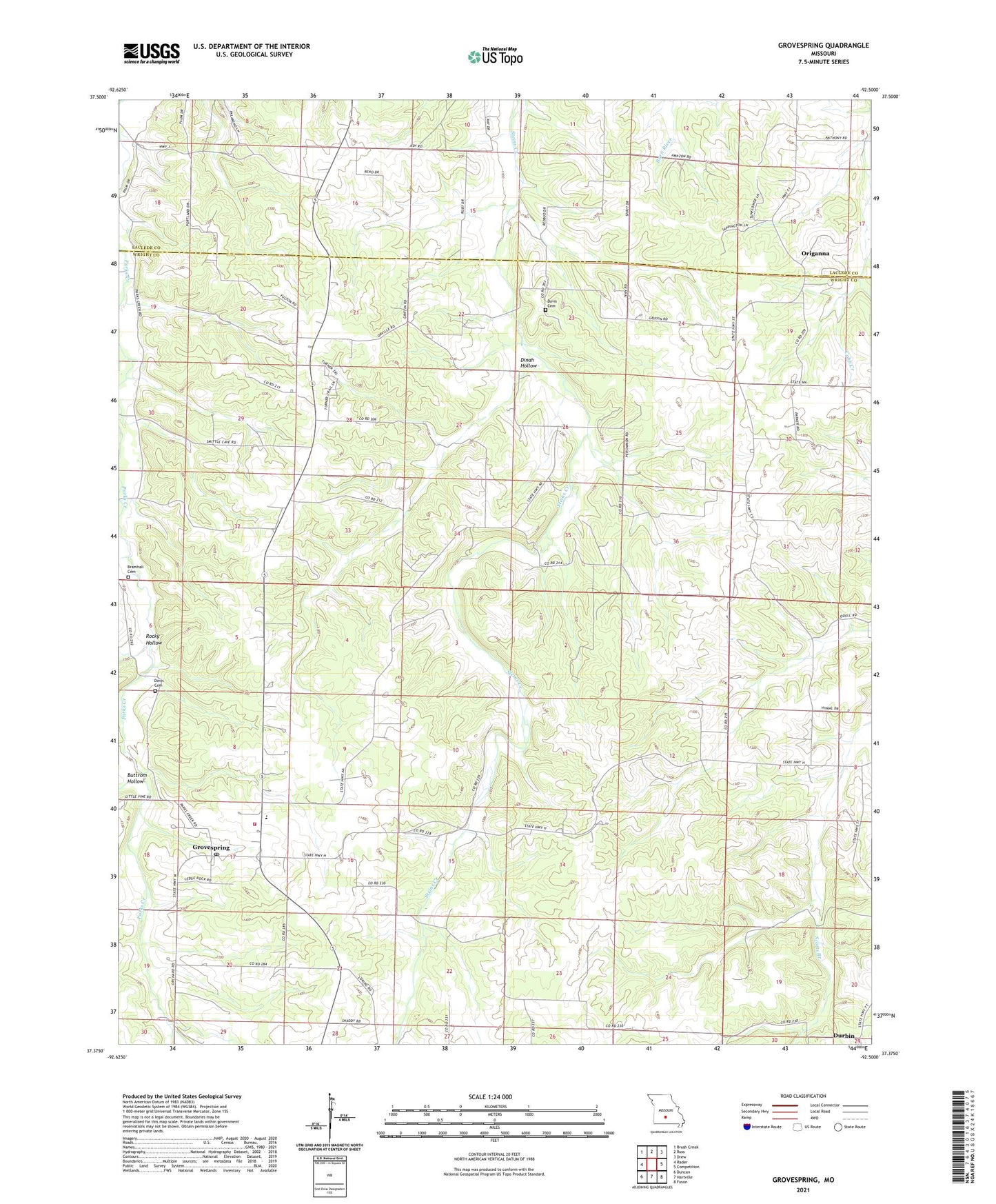
2021 topographic map quadrangle Grovespring in the state of Missouri. Scale: 1:24000. Based on the newly updated USGS 7.5' US Topo map series, this map is in the following counties: Wright, Laclede. The map contains contour data, water features, and other items you are used to seeing on USGS maps, but also has updated roads and other features. This is the next generation of topographic maps. Printed on high-quality waterproof paper with UV fade-resistant inks.
Quads adjacent to this one:
West: Rader
Northwest: Brush Creek
North: Russ
Northeast: Drew
East: Competition
Southeast: Fuson
South: Hartville
Southwest: Duncan
This map covers the same area as the classic USGS quad with code o37092d5.
Contains the following named places: Bramhall Cemetery, Buttrom Hollow, Cuba Church, Davis Cemetery, Dinah Hollow, Durbin, Durbin Church, Durbin School, Fairview Church, Grovespring, Grovespring Area Voluntary Fire Protection Association Station 1, Grovespring Census Designated Place, Grovespring Post Office, Hall School, Mount Olive School, Origanna, Pleasant View Church, Rocky Hollow, Shady Church, Smittle, Smittle School, Township of Union, Winters School, ZIP Code: 65662