MyTopo
Cape Girardeau NE Missouri US Topo Map
Couldn't load pickup availability
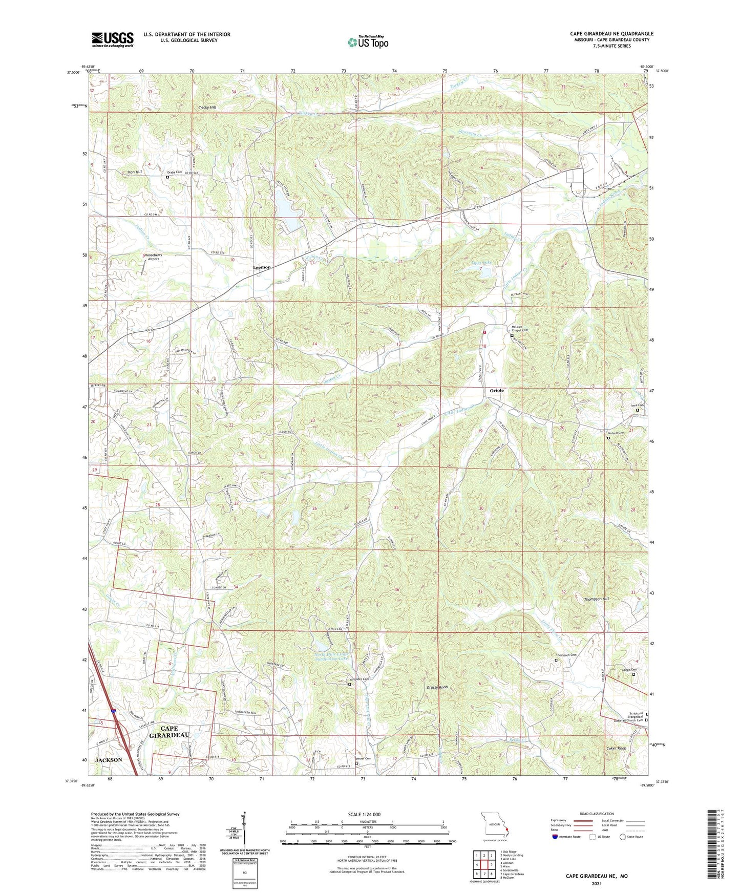
2021 topographic map quadrangle Cape Girardeau NE in the state of Missouri. Scale: 1:24000. Based on the newly updated USGS 7.5' US Topo map series, this map is in the following counties: Cape Girardeau. The map contains contour data, water features, and other items you are used to seeing on USGS maps, but also has updated roads and other features. This is the next generation of topographic maps. Printed on high-quality waterproof paper with UV fade-resistant inks.
Quads adjacent to this one:
West: Jackson
Northwest: Oak Ridge
North: Neelys Landing
Northeast: Wolf Lake
East: Ware
Southeast: McClure
South: Cape Girardeau
Southwest: Gordonville
Contains the following named places: Bella Vista Lake, Coker Knob, Draby Cemetery, Duskin Creek, East County Fire Protection District Station 2 Indian Creek Station, Grassy Knob, Heuer Cemetery, Indian Creek School, Iona Cemetery, Iona Church, Iron Hill, KBSI-TV (Cape Girardeau), KEZS-FM (Cape Girardeau), KFVS-TV (Cape Girardeau), Lange Cemetery, Leemon, Lipps Dam, Lipps Lake, Little Indian Creek, McLains Chapel, Mooseberry Airport, Noland Cemetery, North Hills Estate Subdivision Lake, North Hills Estate Subdivision Lake Dam, Number 819 Dam, Old Camp Ground, Old McKendree Chapel, Opossum Creek, Oriole, Plainview School, Randol School, Rock Hill Church, Thompson Cemetery, Thompson Hill, Township of Randol, Tricky Hill, Vangilder Cemetery, Wesley United Church, Williams School, Zierath Cemetery