MyTopo
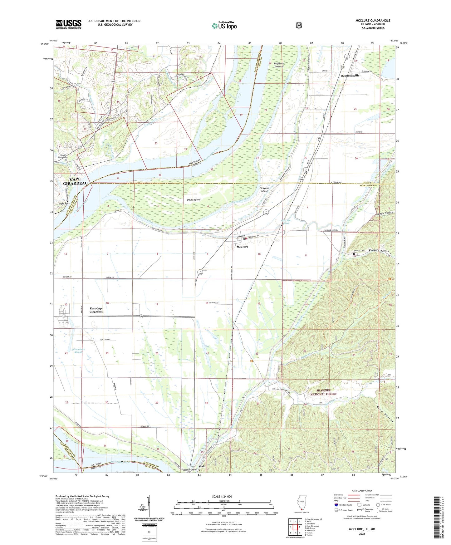
McClure Illinois US Topo Map
Couldn't load pickup availability
Also explore the McClure Forest Service Topo of this same quad for updated USFS data
2024 topographic map quadrangle McClure in the states of Illinois, Missouri. Scale: 1:24000. Based on the newly updated USGS 7.5' US Topo map series, this map is in the following counties: Alexander, Cape Girardeau, Union, Scott. The map contains contour data, water features, and other items you are used to seeing on USGS maps, but also has updated roads and other features. This is the next generation of topographic maps. Printed on high-quality waterproof paper with UV fade-resistant inks.
Quads adjacent to this one:
West: Cape Girardeau
Northwest: Cape Girardeau NE
North: Ware
Northeast: Jonesboro
East: Mill Creek
Southeast: Tamms
South: Thebes
Southwest: Scott City
Contains the following named places: Big Inch Pipe Line, Blue Hollow, Brooks School, Cape Rock, Clear Creek, Devils Island, Dongola Hollow, East Cape - McClure Fire Department, East Cape Election Precinct, East Cape Girardeau, East Cape Girardeau Airport, East Cape Girardeau School, Edmondson Slough, Flora Creek, Hacker Bend, Happy Hollow, Hobbs Chapel, Hobbs Chapel Cemetery, Horse Creek, Juden Creek, KGIR-AM (Cape Girardeau), KZIM-AM (Cape Girardeau), Lindsay Cemetery, Little Flora Creek, Main Ditch, McCavens School, McClure, McClure Election Precinct, McClure Post Office, Old Clear Creek, Picayune Chute, Picayune Island, Reynoldsville, Reynoldsville School, Scism Creek, Shawnee Elementary School-South, Soakie Creek, Swiftsure Towhead, Village of East Cape Girardeau, Village of McClure, ZIP Code: 62957