MyTopo
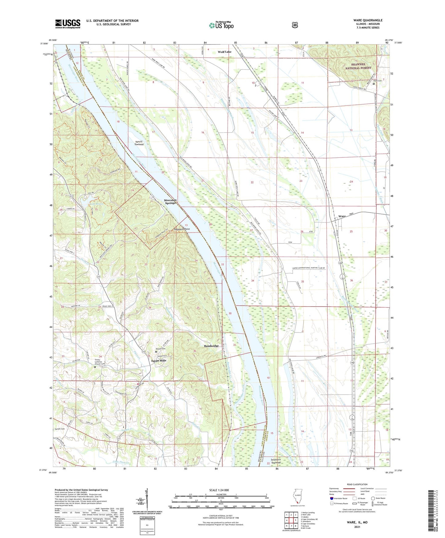
Ware Illinois US Topo Map
Couldn't load pickup availability
Also explore the Ware Forest Service Topo of this same quad for updated USFS data
2024 topographic map quadrangle Ware in the states of Illinois, Missouri. Scale: 1:24000. Based on the newly updated USGS 7.5' US Topo map series, this map is in the following counties: Union, Cape Girardeau. The map contains contour data, water features, and other items you are used to seeing on USGS maps, but also has updated roads and other features. This is the next generation of topographic maps. Printed on high-quality waterproof paper with UV fade-resistant inks.
Quads adjacent to this one:
West: Cape Girardeau NE
Northwest: Neelys Landing
North: Wolf Lake
Northeast: Cobden
East: Jonesboro
Southeast: Mill Creek
South: McClure
Southwest: Cape Girardeau
Contains the following named places: Bainbridge, Bainbridge Creek, Big Barn School, Conaway Lake, East County Fire Protection District Station 1, Ebenezer Church, Egypt Mills, Hamburg Landing, Hamburg School, Indian Creek, Iona School, Lake Boutin, Lake Boutin Dam, Line C Ditch, Miller Pond School, Moccasin Springs, Number 7 Ditch, Rallo Cemetery, Shawnee High School, Sheppard Point, Sublette School, Trail of Tears State Park, Turkey Creek, Union County State Conservation Area, Union District Number 1 Election Precinct, Union Election Precinct, Vancill Towhead, Ware, Ware Baptist Church, Ware United Methodist Church, Willard Landing