MyTopo
Centertown NW Missouri US Topo Map
Couldn't load pickup availability
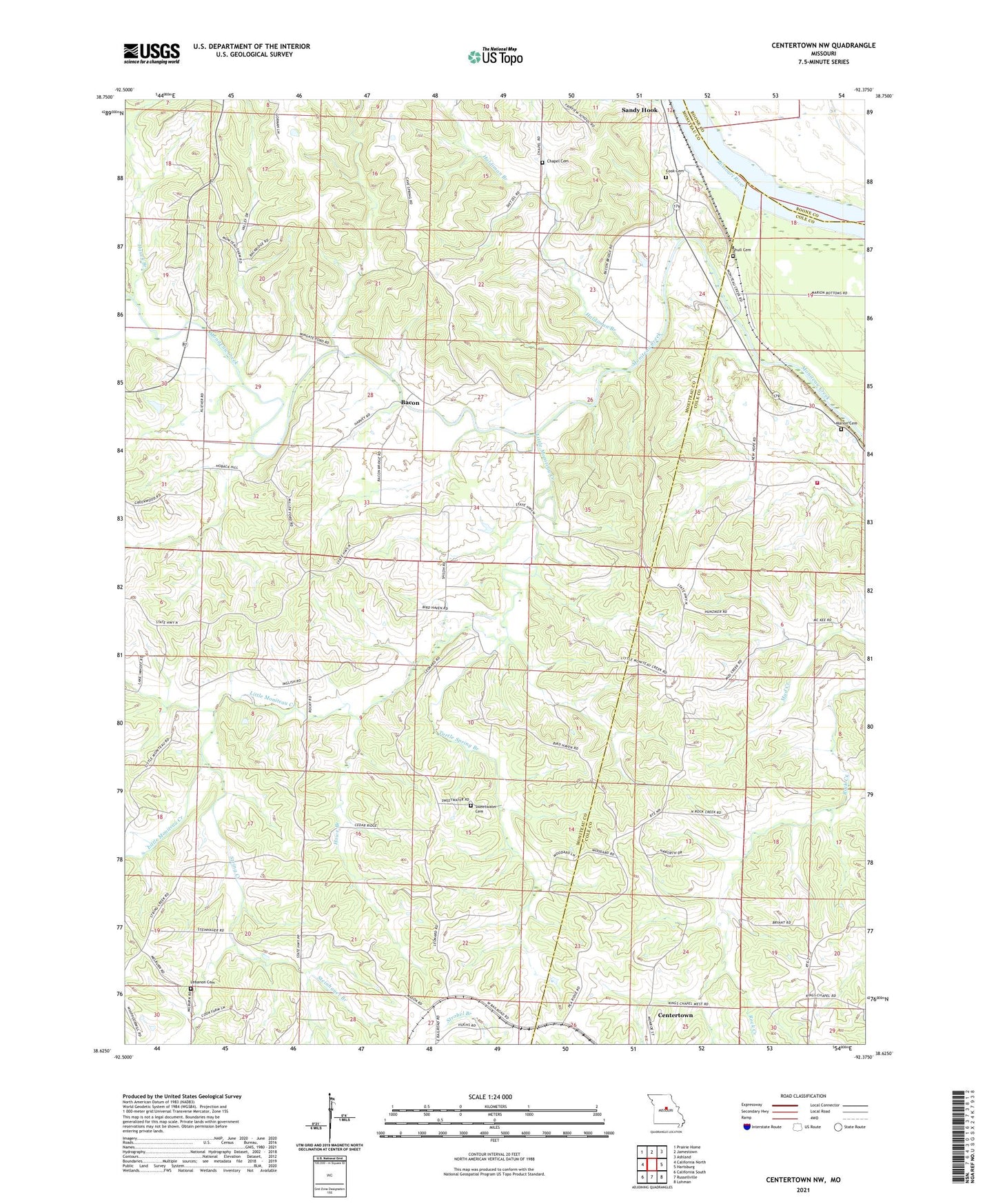
2021 topographic map quadrangle Centertown NW in the state of Missouri. Scale: 1:24000. Based on the newly updated USGS 7.5' US Topo map series, this map is in the following counties: Moniteau, Cole, Boone. The map contains contour data, water features, and other items you are used to seeing on USGS maps, but also has updated roads and other features. This is the next generation of topographic maps. Printed on high-quality waterproof paper with UV fade-resistant inks.
Quads adjacent to this one:
West: California North
Northwest: Prairie Home
North: Jamestown
Northeast: Ashland
East: Hartsburg
Southeast: Lohman
South: Russellville
Southwest: California South
Contains the following named places: Bacon, Chapel Cemetery, Chapel Church, Cook Cemetery, Eldorado School, Fairview School, Haldiman Branch, Harlan School, Hauck Branch, Hills Chapel, Howe Branch, Jenkins Lake Dam, KTXY-FM (Jefferson City), Lebanon Cemetery, Little Moniteau Creek, Lone Star School, Longan Lake Dam, Marion Cemetery, Marion School, Mayhugh Lake Dam, Mud Creek School, Mulberry School, New Hope Church, Pleasant Valley School, Regional West Fire Protection District Station 4, Richward W Cook Junior Dam, Rock Creek School, Sandy Hook, Shiloh Church, Shiloh School, Shull Cemetery, Steinhauer Branch, String Creek, Sweetwater Cemetery, Turtle Spring Branch, Union School, Wingate Ford, ZIP Code: 65023