MyTopo
California South Missouri US Topo Map
Couldn't load pickup availability
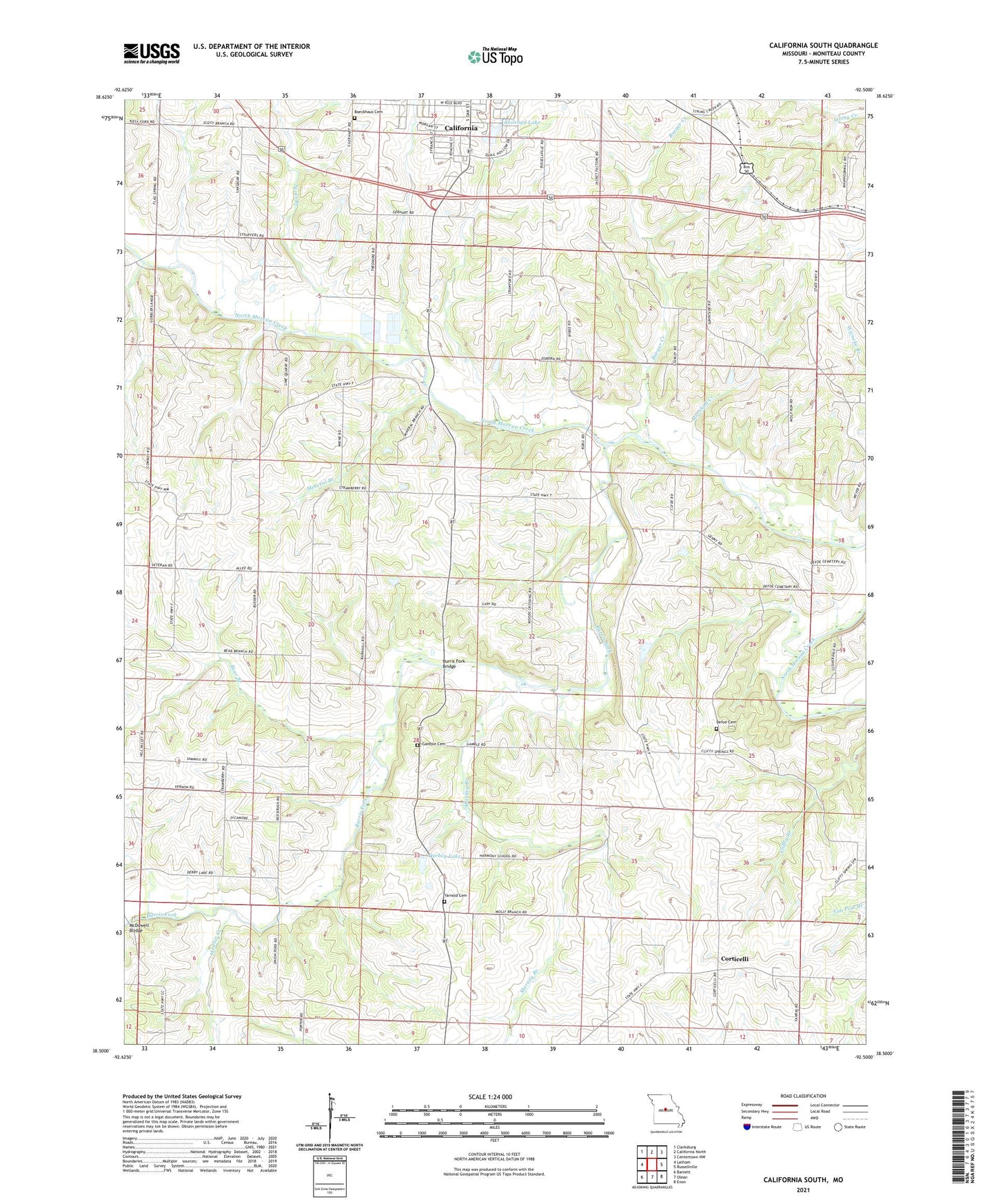
2021 topographic map quadrangle California South in the state of Missouri. Scale: 1:24000. Based on the newly updated USGS 7.5' US Topo map series, this map is in the following counties: Moniteau. The map contains contour data, water features, and other items you are used to seeing on USGS maps, but also has updated roads and other features. This is the next generation of topographic maps. Printed on high-quality waterproof paper with UV fade-resistant inks.
Quads adjacent to this one:
West: Latham
Northwest: Clarksburg
North: California North
Northeast: Centertown NW
East: Russellville
Southeast: Enon
South: Olean
Southwest: Barnett
This map covers the same area as the classic USGS quad with code o38092e5.
Contains the following named places: Bear Branch, Boeckhaus Cemetery, Brant, Burger Creek, Burris Fork, Burris Fork Bridge, Community Chapel, Corticelli, Corticelli Church, Defoe Cemetery, Derbey Lake, Flag Spring Church, Friendship Church, Gamble Cemetery, Harmony School, Marney Branch, Marshall Creek, Mason School, McDowell Bridge, McMenamy Lake Dam, Medlen Creek, Mineral Branch, Norman School, Number 577 Dam, Oak Hill School, Pluck School, Prairie Grove School, Proctor Park Lake Dam, Railroad Lake, Red Brush School, Rock Island School, Salem Church, Sappington School, Scott Branch, Scott Ford, Sunnyside School, Township of Burris Fork, Union Church, Union Ford, Yarnold Cemetery, ZIP Code: 65018