MyTopo
Chaffee Missouri US Topo Map
Couldn't load pickup availability
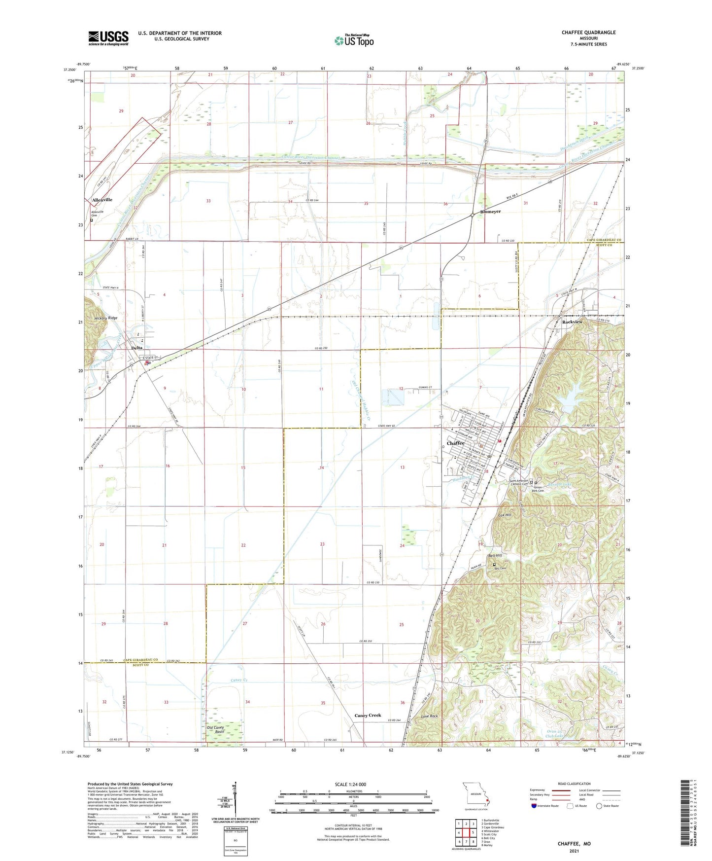
2021 topographic map quadrangle Chaffee in the state of Missouri. Scale: 1:24000. Based on the newly updated USGS 7.5' US Topo map series, this map is in the following counties: Cape Girardeau, Scott. The map contains contour data, water features, and other items you are used to seeing on USGS maps, but also has updated roads and other features. This is the next generation of topographic maps. Printed on high-quality waterproof paper with UV fade-resistant inks.
Quads adjacent to this one:
West: Whitewater
Northwest: Burfordville
North: Gordonville
Northeast: Cape Girardeau
East: Scott City
Southeast: Morley
South: Oran
Southwest: Bell City
Contains the following named places: Allenville Cemetery, Bell Cemetery, Bell Hill, Blomeyer, Boyers, Burnett Lake, Burnett Lake Dam, Caney Creek, Caney Dam, Cedar Cliffs, Chaffee, Chaffee Fire Department, Chaffee Police Department, Chaffee Post Office, City of Chaffee, City of Delta, Cox Hill, Crossroads Shopping Center, Delta, Delta Post Office, Delta Rural Fire Protection District, Deray, Eftink Lake, Eftink Lake Dam, Headwater Diversion Channel, Hindman Creek, Hubble Creek, Johnsons Mills, Kagel, KCGQ-FM (Gordonville), Lake Tywappity, Lauck Lake Dam, Lock Lake, Lone Rock, Millers, Norman, Old Caney Basin, Old Channel Hubble Creek, Oran 25 Club Dam, Oran 25 Club Lake, Quarry, Rockview, Rockview School, Saint Ambrose Catholic Cemetery, Saint Ambrose Catholic Church, Sharpsboro, Suttons, Tywappity Community Dam, Union Park Cemetery, Wylie School, ZIP Codes: 63740, 63744, 63745