MyTopo
Morley Missouri US Topo Map
Couldn't load pickup availability
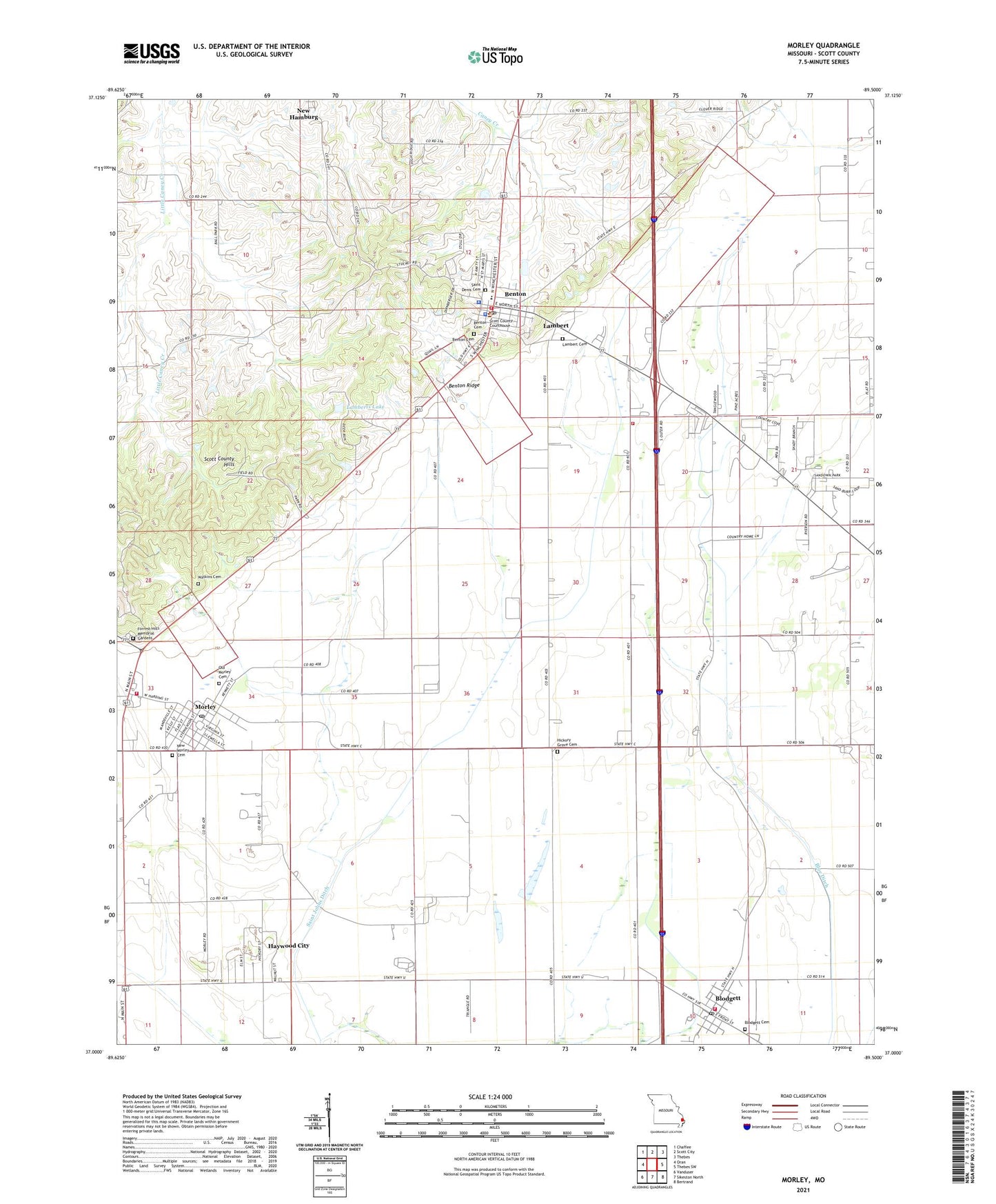
2021 topographic map quadrangle Morley in the state of Missouri. Scale: 1:24000. Based on the newly updated USGS 7.5' US Topo map series, this map is in the following counties: Scott. The map contains contour data, water features, and other items you are used to seeing on USGS maps, but also has updated roads and other features. This is the next generation of topographic maps. Printed on high-quality waterproof paper with UV fade-resistant inks.
Quads adjacent to this one:
West: Oran
Northwest: Chaffee
North: Scott City
Northeast: Thebes
East: Thebes SW
Southeast: Bertrand
South: Sikeston North
Southwest: Vanduser
This map covers the same area as the classic USGS quad with code o37089a5.
Contains the following named places: Benton, Benton Police Department, Benton Post Office, Benton Ridge, Benton Station, Benton Volunteer Fire Department, Blodgett, Blodgett Cemetery, Blodgett Post Office, Blue Ditch, Brocks Sawmill, City of Benton, City of Morley, Forrest Hills Memorial Gardens, Haywood City, Hickory Grove Cemetery, Hickory Grove Church, Hickory Grove School, Kenton, Lambert, Lambert Cemetery, Lamberts Lake, Lamberts Lake Dam, Lemly, Morley, Morley Post Office, Morley Volunteer Fire Department, New Hamburg / Benton / Commerce Fire Protection District, New Morley Cemetery, Old Morley Cemetery, Poor Farm, Redman, Saint Denis Cemetery, Saint Dionysis Church, Scott County, Scott County Hills, Scott County Rural Fire Protection District Station 1, Scott County Rural Fire Protection District Station 2, Scott County Sheriff's Office, Township of Moreland, Village of Blodgett, Village of Haywood City, Village of Lambert, Ward School, ZIP Codes: 63736, 63767, 63824