MyTopo
Oran Missouri US Topo Map
Couldn't load pickup availability
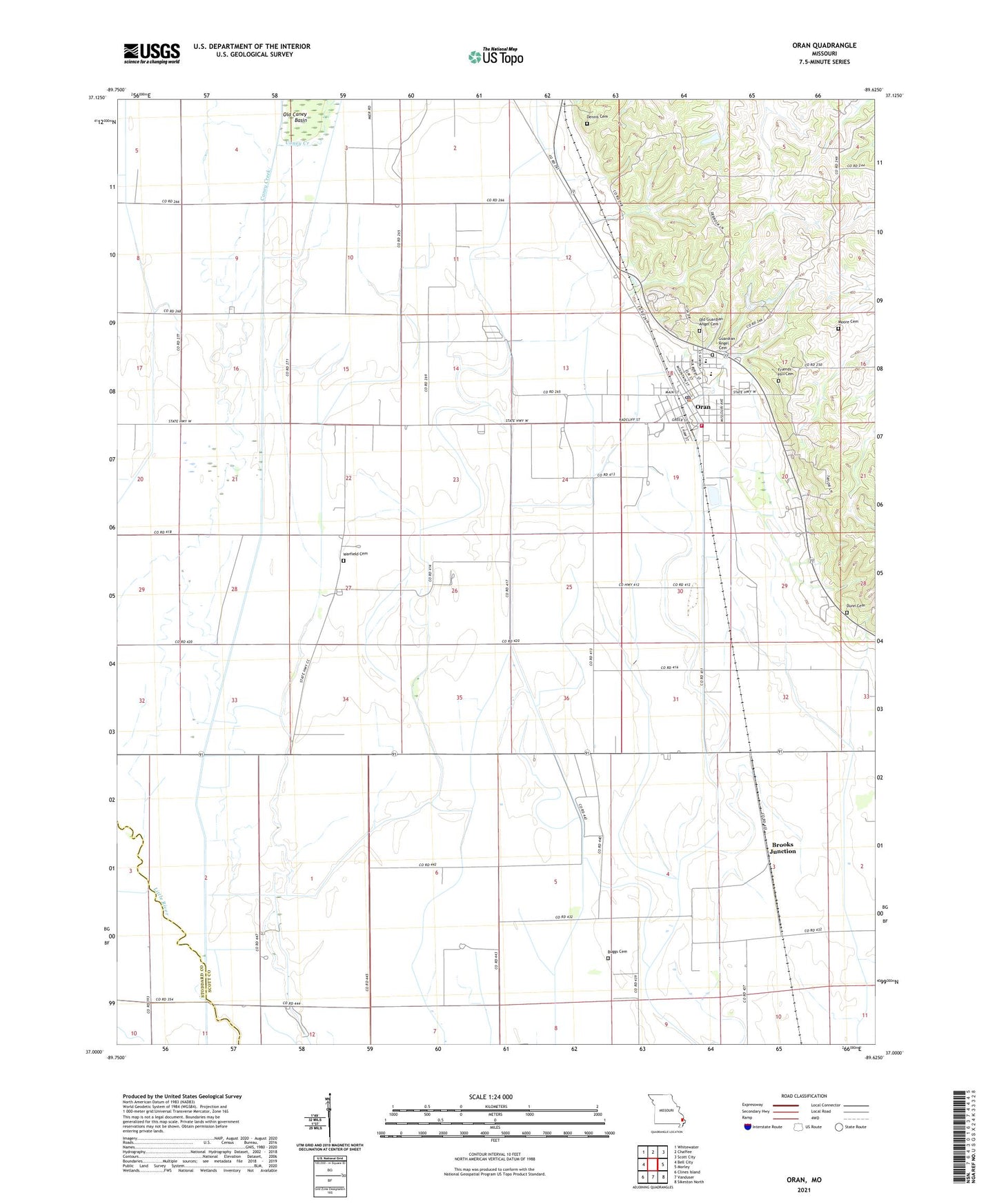
2021 topographic map quadrangle Oran in the state of Missouri. Scale: 1:24000. Based on the newly updated USGS 7.5' US Topo map series, this map is in the following counties: Scott, Stoddard. The map contains contour data, water features, and other items you are used to seeing on USGS maps, but also has updated roads and other features. This is the next generation of topographic maps. Printed on high-quality waterproof paper with UV fade-resistant inks.
Quads adjacent to this one:
West: Bell City
Northwest: Whitewater
North: Chaffee
Northeast: Scott City
East: Morley
Southeast: Sikeston North
South: Vanduser
Southwest: Clines Island
This map covers the same area as the classic USGS quad with code o37089a6.
Contains the following named places: Beaverdam, Bleda, Bleda School, Brooks Junction, Bryan School, Bugg School, Buggs Cemetery, Caney Creek, City of Oran, Dennis Cemetery, Dunn Cemetery, East Channel Lower Whitewater Creek, Eftink Dam, Eftink Lake, Fellowship Church, Friends Hill Cemetery, Gangle School, Guardian Angel Church, Hooe Church, Hooe School, Hunter School, Lookout Mountain Resort Dam, Lookout Mountain Resort Lake, Moore Cemetery, New Home Church, Old Guardian Angel Cemetery, Oran, Oran Fire Protection District, Oran Police Department, Oran Post Office, Parker, Township of Morley, Township of Sylvania, Warfield Cemetery, ZIP Code: 63771