MyTopo
Scott City Missouri US Topo Map
Couldn't load pickup availability
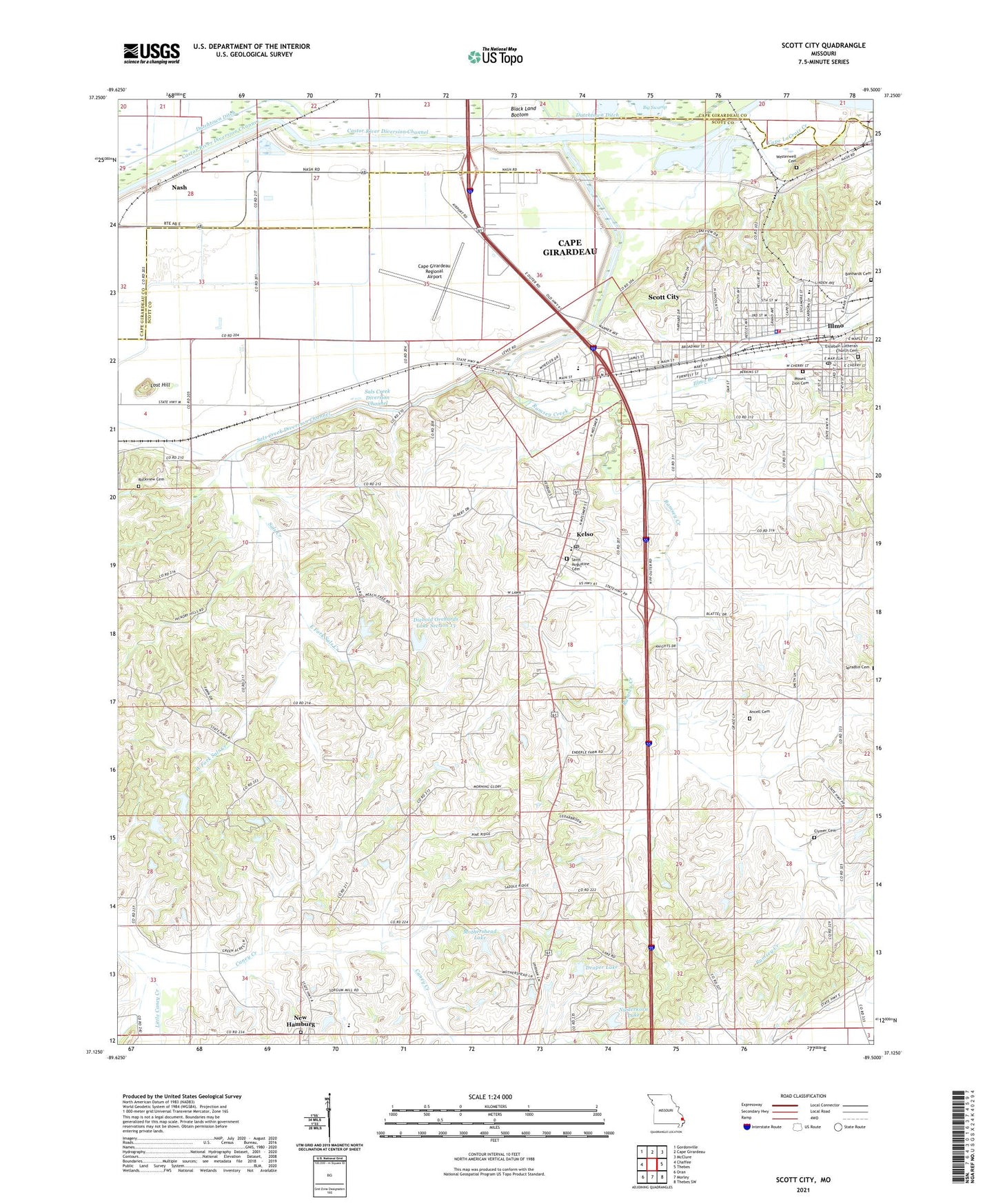
2021 topographic map quadrangle Scott City in the state of Missouri. Scale: 1:24000. Based on the newly updated USGS 7.5' US Topo map series, this map is in the following counties: Scott, Cape Girardeau. The map contains contour data, water features, and other items you are used to seeing on USGS maps, but also has updated roads and other features. This is the next generation of topographic maps. Printed on high-quality waterproof paper with UV fade-resistant inks.
Quads adjacent to this one:
West: Chaffee
Northwest: Gordonville
North: Cape Girardeau
Northeast: McClure
East: Thebes
Southeast: Thebes SW
South: Morley
Southwest: Oran
This map covers the same area as the classic USGS quad with code o37089b5.
Contains the following named places: Ancell Cemetery, Anton Niederkorn Dam, Bonhardt Cemetery, Cape Girardeau Regional Airport, City of Scott City, Clymer Cemetery, Debol School, Diebold Orchards Lake Section 13, Diebold Orchards Section 13 Dam, Diebold Orchards Section 14 Dam, Diebold Orchards Section 14 Lake, Draper Lake, Draper Lake Dam, Dutchtown Ditch, East Fork Sals Creek, Eisleben Church, Hilltop, Illmo, Illmo Branch, Illmo-Scott City School, Kaechels, Kelso, Kelso Post Office, Little Caney Creek, Lost Hill, Marquette Lakes, Massey, Mothershead Lake, Mothershead Lake Dam, Mount Zion Cemetery, Nash, New Hamburg, New Hamburg Census Designated Place, Niederkorn Lake, Pleasant Hill Church, Pleasant Hill School, Ramsey Branch, Ramsey Creek, Ramsey Creek Diversion Channel, Rockview Cemetery, Saint Lawrence Church, Sals Creek, Sals Creek Diversion Channel, Scott City, Scott City Fire Department, Scott City Police Department, Scott City Post Office, Shearer School, Township of Kelso, Village of Kelso, West Fork Sals Creek, Westerwell Cemetery, ZIP Codes: 63758, 63780