MyTopo
Clifton City Missouri US Topo Map
Couldn't load pickup availability
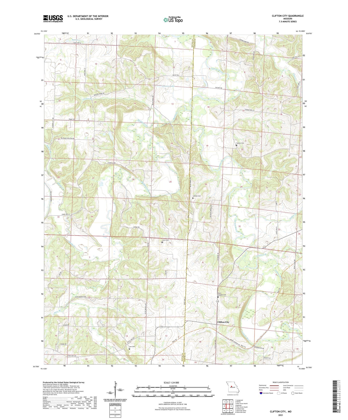
2021 topographic map quadrangle Clifton City in the state of Missouri. Scale: 1:24000. Based on the newly updated USGS 7.5' US Topo map series, this map is in the following counties: Pettis, Cooper. The map contains contour data, water features, and other items you are used to seeing on USGS maps, but also has updated roads and other features. This is the next generation of topographic maps. Printed on high-quality waterproof paper with UV fade-resistant inks.
Quads adjacent to this one:
West: Beaman
Northwest: Longwood
North: Nelson
Northeast: Pilot Grove North
East: Pilot Grove South
Southeast: Otterville East
South: Otterville West
Southwest: Sedalia East
Contains the following named places: Bush, Clifton City, Clifton City Fire Department, Dickman Lake Dam, Dilthey Lake Dam, Fortune Lake Dam, Fortunes Lake, Irwin Cemetery, Johnson Branch, Lamine Cemetery, Lamine Church, Lamine School, Landon Branch, Lee Cemetery, Lookout, Lovelace School, Memorial Church, Mount Moriah Church, Muddy Creek, Olive Branch, Pipkin Branch, Reinharot School, Saint Josephs Cemetery, Scott School, Shaver Creek, Sowers Cemetery, Sweeney, Township of Bowling Green, Township of Heath Creek, Union Church, Vollmer School, Willow Branch