MyTopo
Courtois Missouri US Topo Map
Couldn't load pickup availability
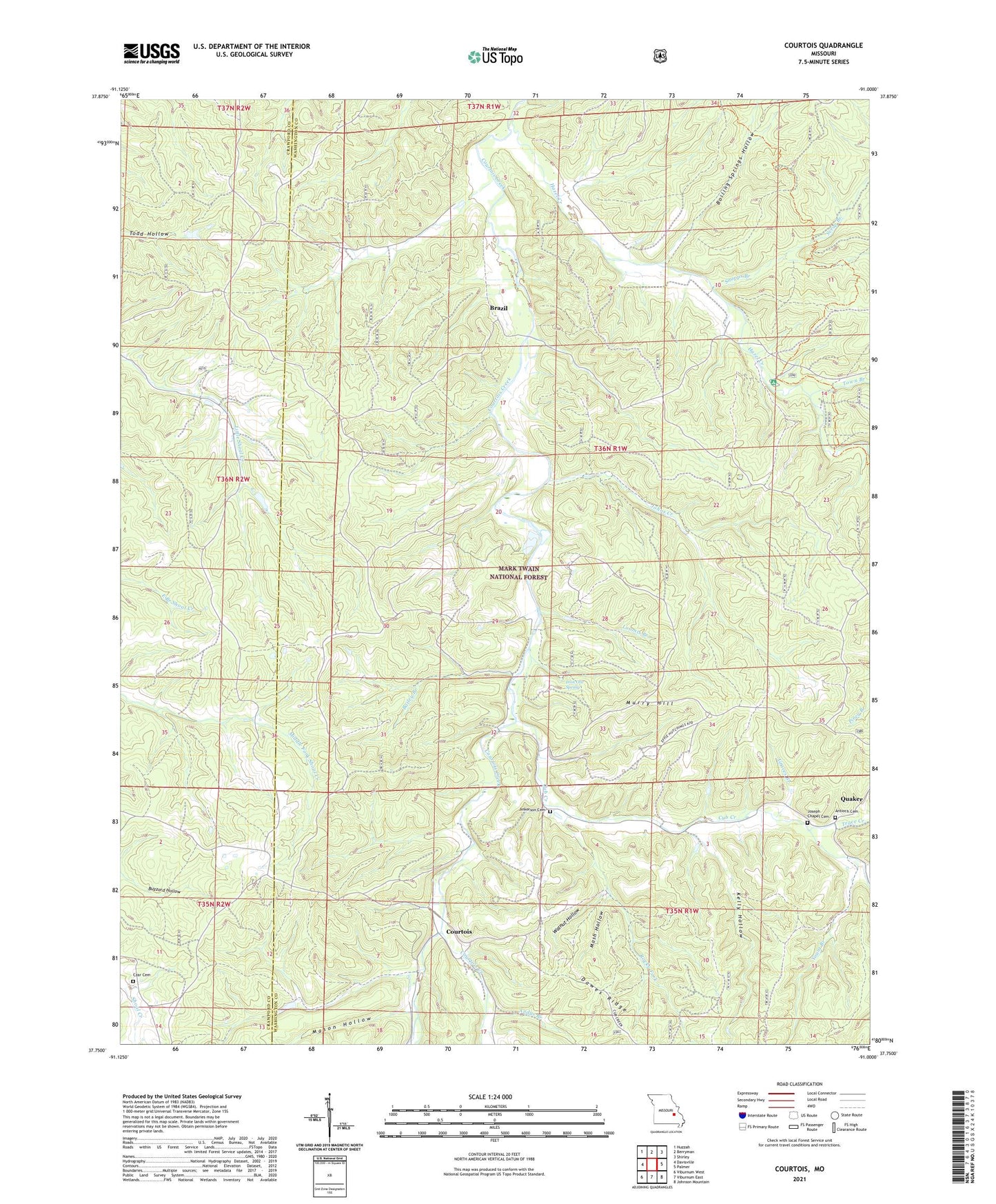
2021 topographic map quadrangle Courtois in the state of Missouri. Scale: 1:24000. Based on the newly updated USGS 7.5' US Topo map series, this map is in the following counties: Washington, Crawford. The map contains contour data, water features, and other items you are used to seeing on USGS maps, but also has updated roads and other features. This is the next generation of topographic maps. Printed on high-quality waterproof paper with UV fade-resistant inks.
Quads adjacent to this one:
West: Davisville
Northwest: Huzzah
North: Berryman
Northeast: Shirley
East: Palmer
Southeast: Johnson Mountain
South: Viburnum East
Southwest: Viburnum West
Contains the following named places: Andys Branch, Antioch Baptist Church, Antioch Cemetery, Antioch Church, Antioch School, Bailey Branch, Bethel Church, Bluff Lead Diggings, Boiling Springs Hollow, Brazil, Coffee-Pot Lead Diggings, Courtois, Cub Creek, Czar, Czar Church, Czar Lookout Tower, Czar School, Ecclesia Church, Graves Branch, Hazel Creek, Hazel Creek Campground, Indian Creek, Iron Ore Spring, Ironore Spring School, Ishmael, Jinkerson Cemetery, Johns Creek, Joseph Chapel, Joseph Chapel Cemetery, Kellogg Shaft, Kelly Hollow, Loomis Branch, Mallow School, Mash Hollow, Mason Hollow, Murry Hill, Number 717 Dam, Number 718 Dam, Pleasant Point School, Polecat Lead Diggings, Quaker, Rocky Fork, Scrap Branch, Snapps Branch, Sugar Grove Church, Town Branch, Township of Harmony, Trace Creek, Walnut Hollow, Water Hill Lead Diggings, Yount Branch