MyTopo
Dissen Missouri US Topo Map
Couldn't load pickup availability
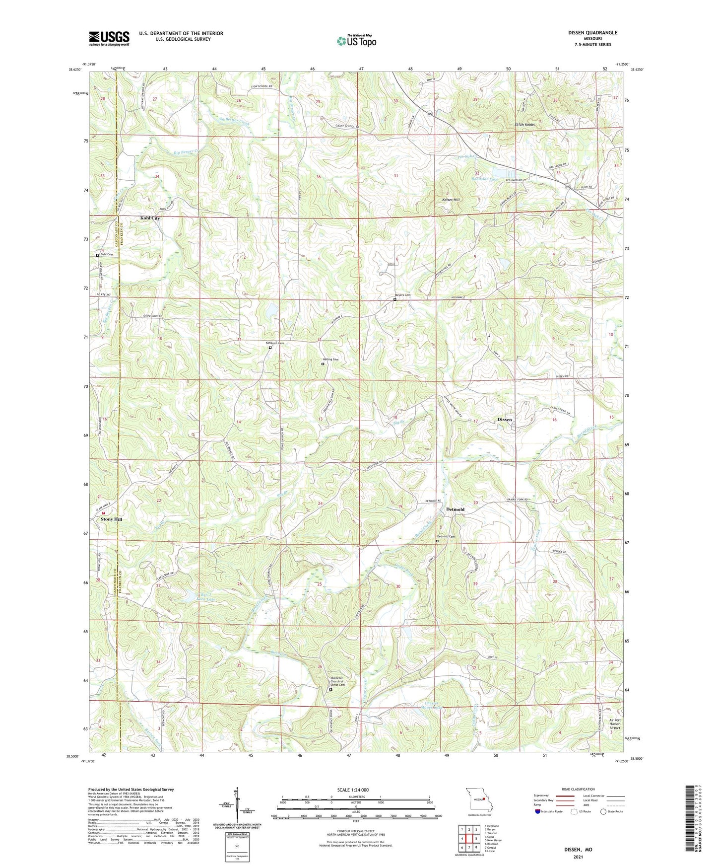
2021 topographic map quadrangle Dissen in the state of Missouri. Scale: 1:24000. Based on the newly updated USGS 7.5' US Topo map series, this map is in the following counties: Franklin, Gasconade. The map contains contour data, water features, and other items you are used to seeing on USGS maps, but also has updated roads and other features. This is the next generation of topographic maps. Printed on high-quality waterproof paper with UV fade-resistant inks.
Quads adjacent to this one:
West: Swiss
Northwest: Hermann
North: Berger
Northeast: Treloar
East: New Haven
Southeast: Leslie
South: Gerald
Southwest: Rosebud
Contains the following named places: Adventist Church, Ben J Koch Lake, Big Branch, Cedar Fork, Cedar Grove School, Chester Mayer Lake, Dahl Cemetery, Detmold, Detmold Cemetery, Detmold School, Dissen, Ebenezer Church of Christ Cemetery, Ebenezer United Church of Christ, Etlah Knobs, Excelsior School, Fork Creek, Good Hope School, Grant School, Helling Cemetery, Kaiser Hill, Koch Lake Dam, Kohl City, Kohlbush Cemetery, Laschke Lake Dam, Lyon School, Maria Vista Retreat, Meyer Lake Dam, Meyers Cemetery, New Haven - Berger Fire Protection District Station 3, Prairie Fork, R-2 School, Roadside Lake, Roadside Lake Dam, Sellenriek Dam, Senate Grove, Senate Grove Church, Stony Hill, Stony Hill Church, Strubberg Lake Dam, Township of Boeuf