MyTopo
Berger Missouri US Topo Map
Couldn't load pickup availability
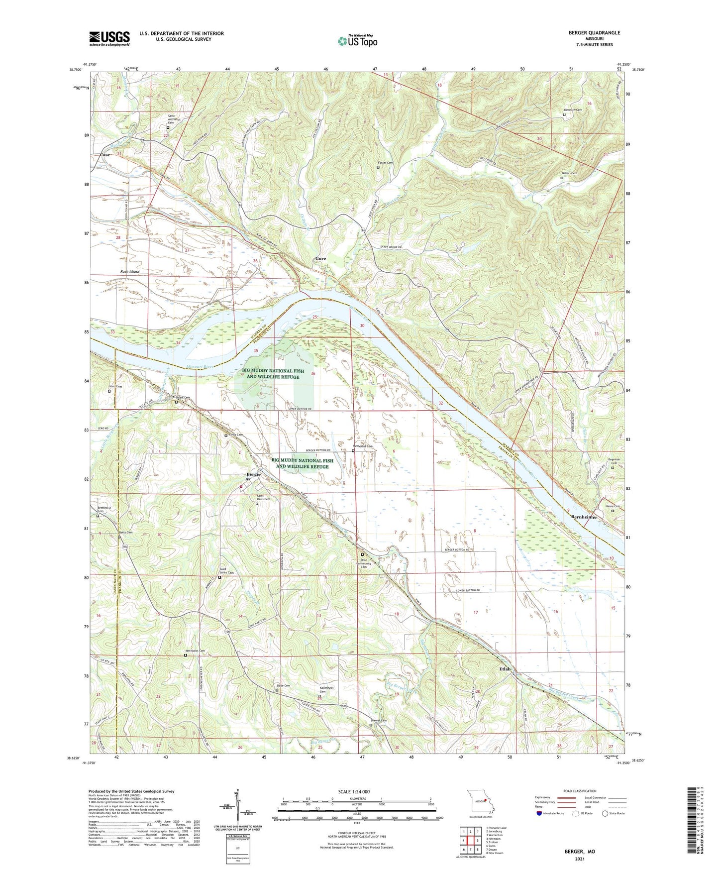
2021 topographic map quadrangle Berger in the state of Missouri. Scale: 1:24000. Based on the newly updated USGS 7.5' US Topo map series, this map is in the following counties: Franklin, Warren, Gasconade. The map contains contour data, water features, and other items you are used to seeing on USGS maps, but also has updated roads and other features. This is the next generation of topographic maps. Printed on high-quality waterproof paper with UV fade-resistant inks.
Quads adjacent to this one:
West: Hermann
Northwest: Pinnacle Lake
North: Jonesburg
Northeast: Warrenton
East: Treloar
Southeast: New Haven
South: Dissen
Southwest: Swiss
This map covers the same area as the classic USGS quad with code o38091f3.
Contains the following named places: Bade Cemetery, Begeman Cemetery, Berger, Berger Post Office, Bernheimer, Bethania Church, Bethlehem School, Betts Cemetery, Bretthorst Cemetery, Case, City of Berger, Clear Branch, Cullum Branch, Drewel Cemetery, Etlah, Etlah Community Cemetery, Finks Cemetery, Foster Cemetery, Gore, Gore School, Gunboat Landing, Haase Cemetery, Haid Cemetery, Kallmeyier Cemetery, Kimmich Cemetery, Little Berger Creek, Little Lost Creek, Lost Creek, Loutre Slough, Lower Bottom School, Massie Creek, Methodist Cemetery, Millers Cemetery, New Haven - Berger Fire Protection District Station 5, Northeastern Ozarks, Oetting Lake Dam, Parsons Lake Dam, Pryors Branch, R-1 School, Roark Cemetery, Rush Island, Rush Island School, Saint Anthony Church, Saint Johns Cemetery, Saint Pauls Cemetery, Sky Ranch Lake Dam, Unanimous School, Upper Bottom School, Wilsons Branch, ZIP Code: 63014