MyTopo
Dogwood Missouri US Topo Map
Couldn't load pickup availability
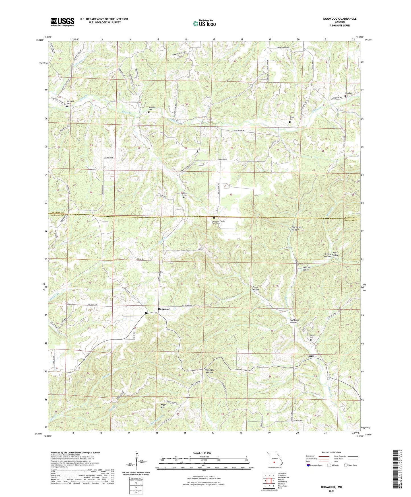
2021 topographic map quadrangle Dogwood in the state of Missouri. Scale: 1:24000. Based on the newly updated USGS 7.5' US Topo map series, this map is in the following counties: Douglas, Webster. The map contains contour data, water features, and other items you are used to seeing on USGS maps, but also has updated roads and other features. This is the next generation of topographic maps. Printed on high-quality waterproof paper with UV fade-resistant inks.
Quads adjacent to this one:
West: Bruner
Northwest: Fordland
North: Seymour
Northeast: Mansfield NW
East: Cedar Gap
Southeast: Ava
South: Goodhope
Southwest: Keltner
Contains the following named places: Bad Branch, Beaver, Beaver School, Beaver Valley Church, Big Spring Hollow, Brixey Hollow, Buck Hollow, Caldwell Church, Cardwell Cemetery, Cedar Hollow, Christian Union Church, Davis School, Denney Cemetery, Depew, Depew Post Office, Dogwood, Dogwood School, Dogwood Tower Site State Hunting Area, Ellison Cemetery, Fairview School, Finley Church, Finley School, Goss Cemetery, Harmony Church, Nazarene Church, Otley, Philpott Cemetery, Pleasant Ridge Church, Ragsdale School, Red Bank Hollow, Sand Hill Hollow, Sarvis Point, Silvey Branch, Silvey Cemetery, Tigris, Township of Finley, Township of Lincoln, Wagner Church, Wagner School