MyTopo
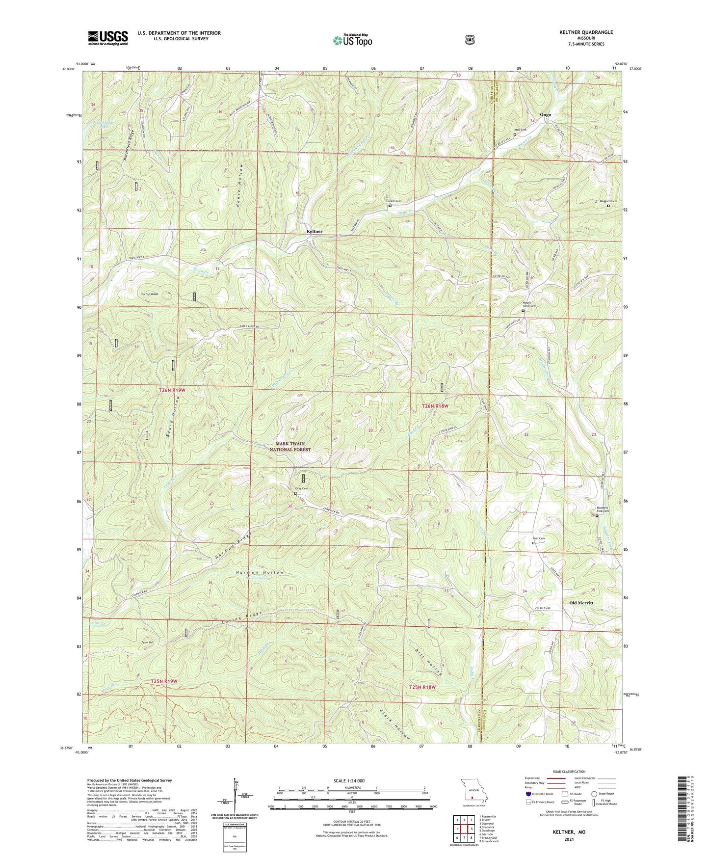
Keltner Missouri US Topo Map
Couldn't load pickup availability
Also explore the Keltner Forest Service Topo of this same quad for updated USFS data
2021 topographic map quadrangle Keltner in the state of Missouri. Scale: 1:24000. Based on the newly updated USGS 7.5' US Topo map series, this map is in the following counties: Christian, Douglas. The map contains contour data, water features, and other items you are used to seeing on USGS maps, but also has updated roads and other features. This is the next generation of topographic maps. Printed on high-quality waterproof paper with UV fade-resistant inks.
Quads adjacent to this one:
West: Chadwick
Northwest: Rogersville
North: Bruner
Northeast: Dogwood
East: Goodhope
Southeast: Brownbranch
South: Bradleyville
Southwest: Garrison
This map covers the same area as the classic USGS quad with code o36092h8.
Contains the following named places: Bill Hollow, Board Hollow, Boulders Fork Cemetery, Buck Branch, Gray Cemetery, Hall Cemetery, Hall School, Harmon Hollow, Harmon Ridge, Harmon Spring, Harvill Cemetery, High Lonesome School, Honey Branch, Keltner, Lead Hill School, Little Cedar Creek, Lost Creek, Loving Ridge, Maggard Cemetery, Marshfield Ridge, Mound Church, Mound School, Mount Olive Church, Nance Hollow, Old Merritt, Ongo, Peters Branch, Punching Creek, Sugar Camp Creek, Tater Hill, Township of Lead Hill, Turnip Knob, Union Hill Church, Union Hill School, Walnut Grove School, ZIP Code: 65720