MyTopo
Cedar Gap Missouri US Topo Map
Couldn't load pickup availability
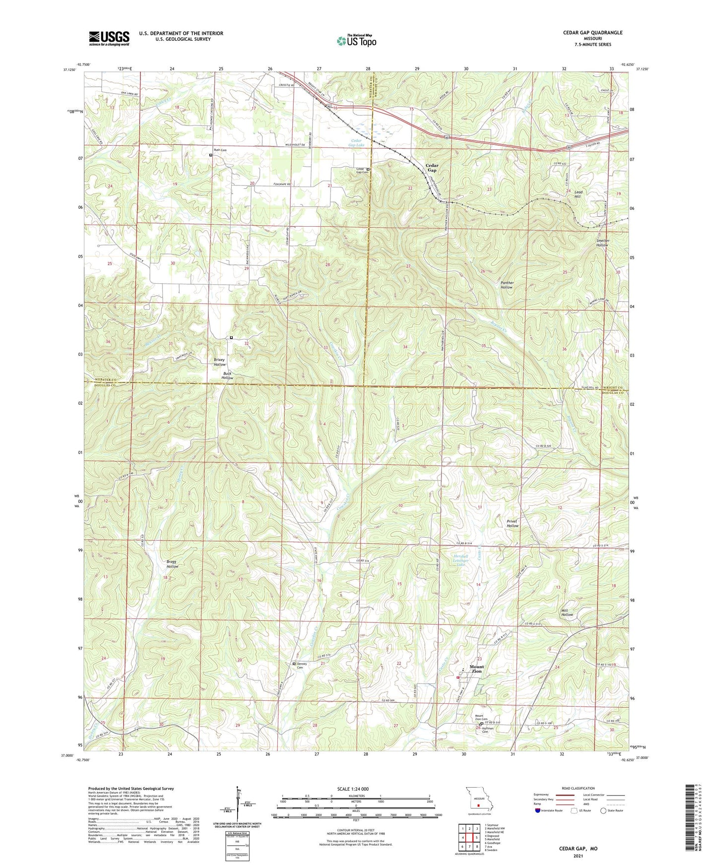
2021 topographic map quadrangle Cedar Gap in the state of Missouri. Scale: 1:24000. Based on the newly updated USGS 7.5' US Topo map series, this map is in the following counties: Douglas, Webster, Wright. The map contains contour data, water features, and other items you are used to seeing on USGS maps, but also has updated roads and other features. This is the next generation of topographic maps. Printed on high-quality waterproof paper with UV fade-resistant inks.
Quads adjacent to this one:
West: Dogwood
Northwest: Seymour
North: Mansfield NW
Northeast: Mansfield NE
East: Mansfield
Southeast: Sweden
South: Ava
Southwest: Goodhope
This map covers the same area as the classic USGS quad with code o37092a6.
Contains the following named places: Ava Rural Fire Department Station 2, Bragg Hollow, Brush Arbor Church, Cedar Gap, Cedar Gap Cemetery, Cedar Gap Dam, Cedar Gap Lake, Cedar Gap School, Day Church, Denney Cemetery, Farthing East Dam, Farthing West Dam, Flint Point School, Gentry Church, Gentry School, Glad Hill Church, Granada, Granada School, Hershell Letsinger Lake, Huffman Cemetery, Lead Hill, Lead Hill Church, Letsinger Lake Dam, Mount Zion, Mount Zion Cemetery, Mountain Side School, Panther Hollow, Rush Cemetery, Sky Light School, Township of Findley, Zenda