MyTopo
Dongola Missouri US Topo Map
Couldn't load pickup availability
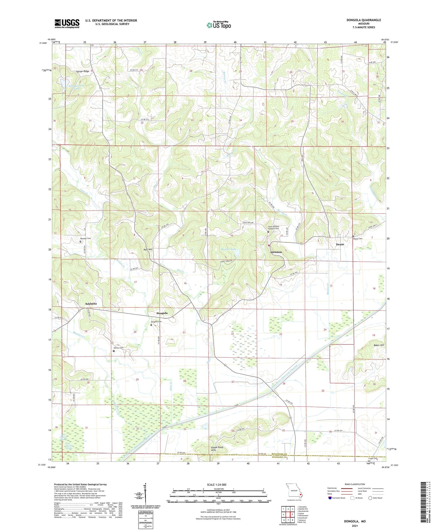
2021 topographic map quadrangle Dongola in the state of Missouri. Scale: 1:24000. Based on the newly updated USGS 7.5' US Topo map series, this map is in the following counties: Bollinger, Stoddard. The map contains contour data, water features, and other items you are used to seeing on USGS maps, but also has updated roads and other features. This is the next generation of topographic maps. Printed on high-quality waterproof paper with UV fade-resistant inks.
Quads adjacent to this one:
West: Zalma
Northwest: Glenallen
North: Marble Hill
Northeast: Burfordville
East: Whitewater
Southeast: Bell City
South: Advance
Southwest: Sturdivant
Contains the following named places: Baker Hill, Baker Hill School, Bootheel Planning Region, Cane Creek, Castor River Diversion Channel, Cato Levee, Cruse Cemetery, Dark Cypress Swamp, Dongola, Dongola School, Drum, Dry Creek, Glennon, Goose Pond Hills, Goose Pond Hills School, Hawker Creek, Johnson School, Kellion Cemetery, Leopold Volunteer Fire Department, Little Valley Church, Malone Creek, Mansker Cemetery, Masters Lake, Misters Lake Dam, New Sylvan Church, Null Hill, Saint Anthony Church, Saint Anthony School, Schlatitz, Schlatitz School, Seiler School, Sylvan Ridge, Sylvan Ridge School, Township of Liberty, Whippoorwill Dam, Whippoorwill Lake, ZIP Code: 63760