MyTopo
Advance Missouri US Topo Map
Couldn't load pickup availability
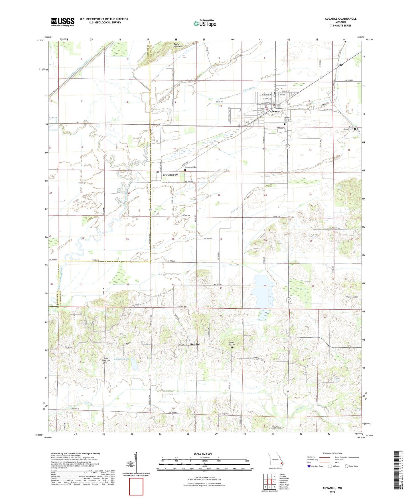
2021 topographic map quadrangle Advance in the state of Missouri. Scale: 1:24000. Based on the newly updated USGS 7.5' US Topo map series, this map is in the following counties: Stoddard, Bollinger. The map contains contour data, water features, and other items you are used to seeing on USGS maps, but also has updated roads and other features. This is the next generation of topographic maps. Printed on high-quality waterproof paper with UV fade-resistant inks.
Quads adjacent to this one:
West: Sturdivant
Northwest: Zalma
North: Dongola
Northeast: Whitewater
East: Bell City
Southeast: Clines Island
South: Bloomfield
Southwest: Acorn Ridge
This map covers the same area as the classic USGS quad with code o37089a8.
Contains the following named places: Advance, Advance Fire Department, Advance Police Department, Advance Post Office, Bluff, Brownwood, Brownwood Cemetery, Brownwood Post Office, Castor, City of Advance, Horseshoe Lake, Johnsons Lake, Johnsons Lake Dam, Liberty Hill Cemetery, Liberty Hill School, Little Rock School, Little Vine School, Morgan Memorial Park Cemetery, Pleasant Grove Church, Rendleman Lake Dam, Rock Point Cemetery, Rock Point School, Saint Joseph Cemetery, Swan Pond, Swan Pond School, Swinton, Tilley Ditch, Toga, Wolf Creek, Woodlawn School, ZIP Codes: 63730, 63738