MyTopo
Sturdivant Missouri US Topo Map
Couldn't load pickup availability
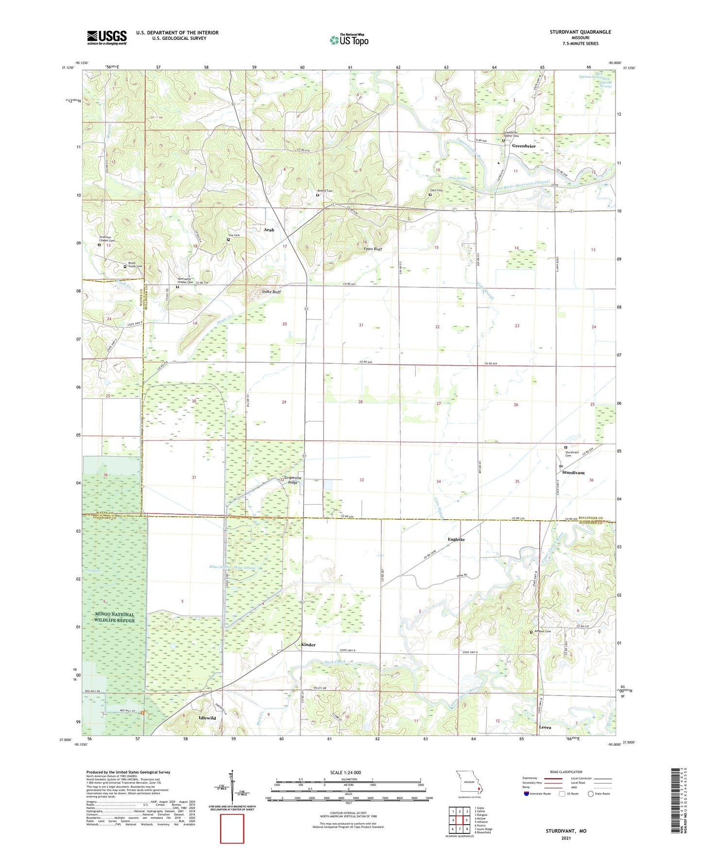
2021 topographic map quadrangle Sturdivant in the state of Missouri. Scale: 1:24000. Based on the newly updated USGS 7.5' US Topo map series, this map is in the following counties: Bollinger, Stoddard, Wayne. The map contains contour data, water features, and other items you are used to seeing on USGS maps, but also has updated roads and other features. This is the next generation of topographic maps. Printed on high-quality waterproof paper with UV fade-resistant inks.
Quads adjacent to this one:
West: McGee
Northwest: Gipsy
North: Zalma
Northeast: Dongola
East: Advance
Southeast: Bloomfield
South: Acorn Ridge
Southwest: Puxico
This map covers the same area as the classic USGS quad with code o37090a1.
Contains the following named places: Abernathy Chapel, Acuff and Ayers Lake, Acuff and Ayers Lake Dam, Arab, Bethel Church, Brush Creek, Brush Creek Church, Calvary Church, Cato Cemetery, Cato Slough, Cox Cemetery, Cox Chapel, Dark Cypress Swamp State Wildlife Area, Ditch Number 1, Duck Creek, Duck Creek Conservation Area, Duck Creek State Wildlife Management Area, Duck Creek State Wildlife Refuge Number 1 Dam, Duck Creek State Wildlife Refuge Number 2 Dam, Duck Creek State Wildlife Refuge Number 3 Dam, Eaglette, Eastern Ozark Border, Ellison Lake, Fears Bluff, Foleys, Grapevine Ridge, Greenbrier, Greenbrier School, Headquarters, Idlewild, Kimbrel Cemetery, Kinder, Kinder Chapel, Leora, Mononame 468 Dam, Pool Eight, Richardson, Slagle Creek, Slagle School, Snake Bluff, Snake Bluff Church, Snake Bluff School, Stepp School, Stratman Chapel, Strobel Lake Dam, Sturdivant, Sturdivant Cemetery, Sturdivant Post Office, Township of Wayne, Ward Dam, Ward Lake, ZIP Code: 63782