MyTopo
Glenallen Missouri US Topo Map
Couldn't load pickup availability
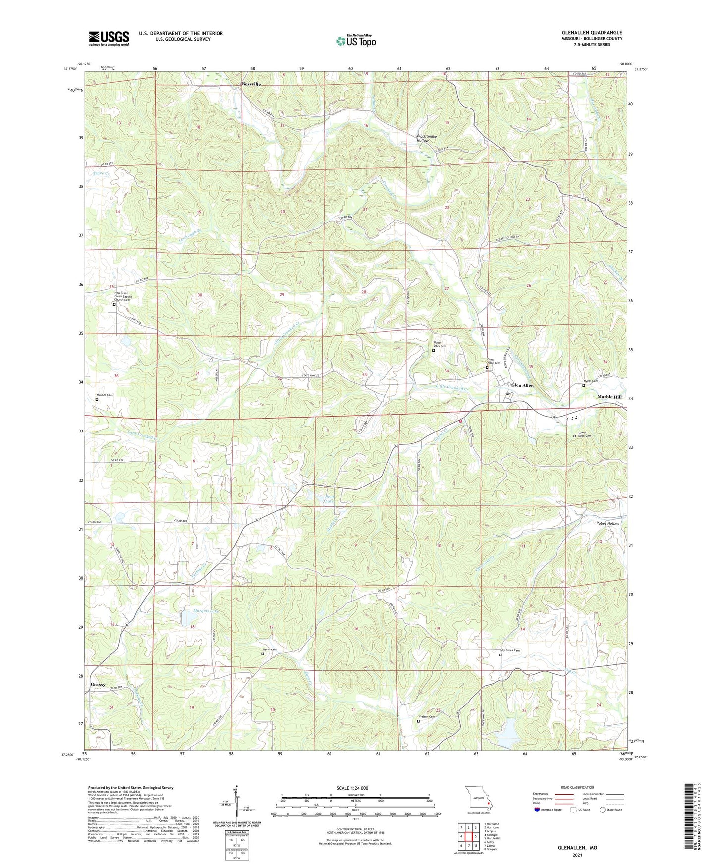
2021 topographic map quadrangle Glenallen in the state of Missouri. Scale: 1:24000. Based on the newly updated USGS 7.5' US Topo map series, this map is in the following counties: Bollinger. The map contains contour data, water features, and other items you are used to seeing on USGS maps, but also has updated roads and other features. This is the next generation of topographic maps. Printed on high-quality waterproof paper with UV fade-resistant inks.
Quads adjacent to this one:
West: Allbright
Northwest: Marquand
North: Hurricane
Northeast: Scopus
East: Marble Hill
Southeast: Dongola
South: Zalma
Southwest: Gipsy
This map covers the same area as the classic USGS quad with code o37090c1.
Contains the following named places: Bessville, Black Snake Hollow, Bollinger County, Dry Creek Cemetery, Dry Creek Church, Dry Creek School, Gimlet Creek, Glenallen, Glenallen Fire Protection Association Station 1, Glenallen Fire Protection Association Station 3, Grassy, Grassy Tower Site State Public Hunting Area, Huxie, Huxie Post Office, Indian Creek, Lake of the Hills, Lake of the Hills Dam, Limbaugh Branch, Little Crooked Creek, Lower Deck Cemetery, Marquis Dam, Marquis Lake, McGee Church, McKelvey School, Mouser Cemetery, Myers Cemetery, New Salem Church, New Trace Creek Church, Number 632 Dam, Oak Grove Church, Opossum Creek School, Point Pleasant Church, Prospect School, Reed Dam, Reed Lake, Robey Hollow, Shelton Cemetery, Shrum School, Town of Glen Allen, Turkey Branch, Upper Deck Cemetery, Woodland School, Wright Lake Dam