MyTopo
Eagle Rock Missouri US Topo Map
Couldn't load pickup availability
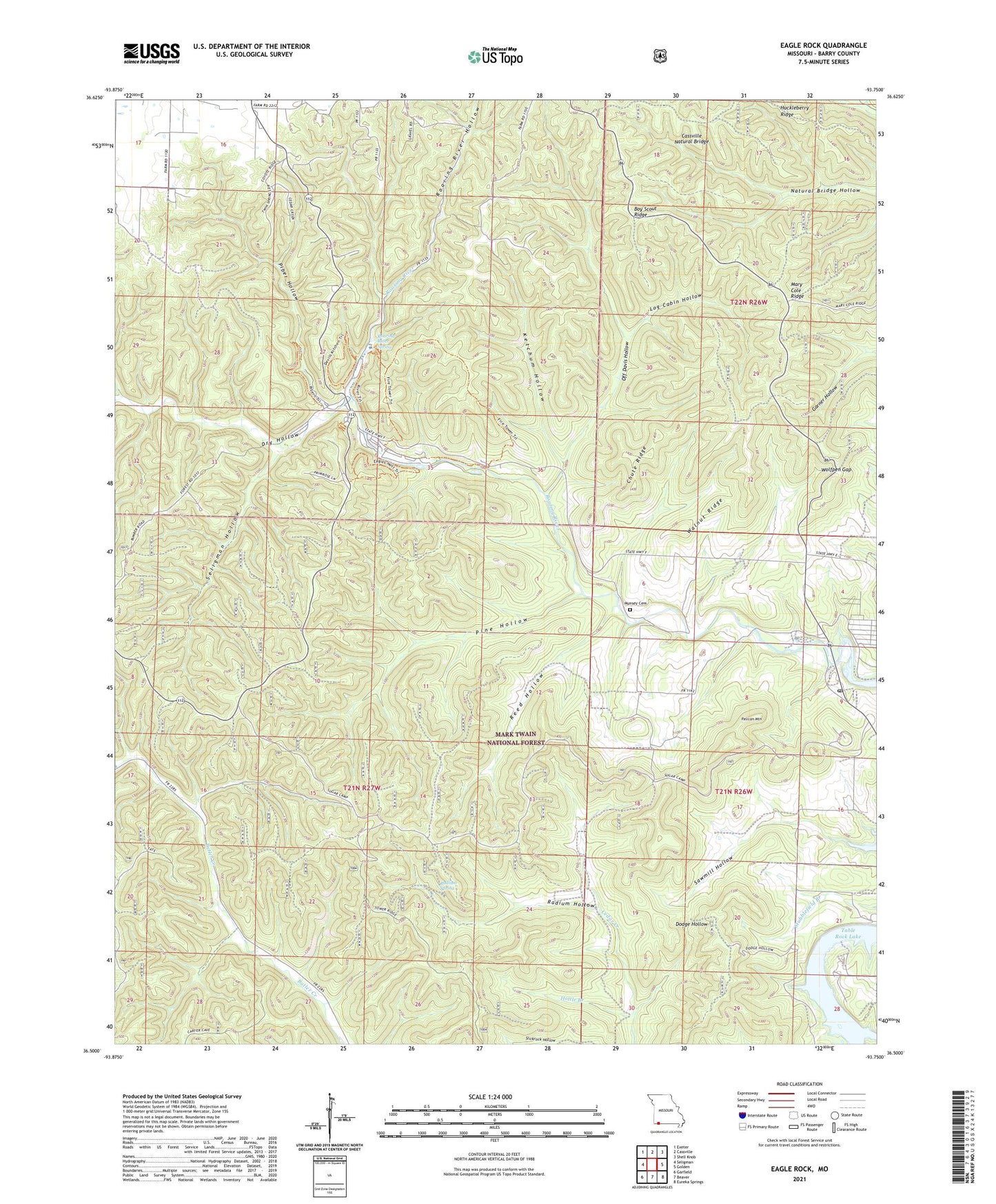
2021 topographic map quadrangle Eagle Rock in the state of Missouri. Scale: 1:24000. Based on the newly updated USGS 7.5' US Topo map series, this map is in the following counties: Barry. The map contains contour data, water features, and other items you are used to seeing on USGS maps, but also has updated roads and other features. This is the next generation of topographic maps. Printed on high-quality waterproof paper with UV fade-resistant inks.
Quads adjacent to this one:
West: Seligman
Northwest: Exeter
North: Cassville
Northeast: Shell Knob
East: Golden
Southeast: Eureka Springs
South: Beaver
Southwest: Garfield
Contains the following named places: Accident School, Boy Scout Ridge, Butler School, Camp Opboca, Cassville Natural Bridge, CCC Camp, Chute Ridge, Dodge Hollow, Dry Hollow, Eagle Rock, Eagle Rock Post Office, Haddock Creek, Hottle Branch, Huckleberry Ridge, Ketchum Hollow, Log Cabin Hollow, Mary Cole Ridge, Mount Zion School, Munsey Cemetery, Munsey School, Off Davis Hollow, Onyx Cave Picnic Area, Pelican Mountain, Piber Hollow, Pine Hollow, Radium Hollow, Radium Spring, Reed Hollow, Roaring River Hollow, Roaring River School, Roaring River Spring, Roaring River State Park, Sawmill Hollow, Seligman Hollow, Sugar Camp Lookout Tower, Talbert Fire Tower, Township of Roaring River, Walnut Ridge, Wolfpen Gap, ZIP Code: 65641