MyTopo
Seligman Missouri US Topo Map
Couldn't load pickup availability
Also explore the Seligman Forest Service Topo of this same quad for updated USFS data
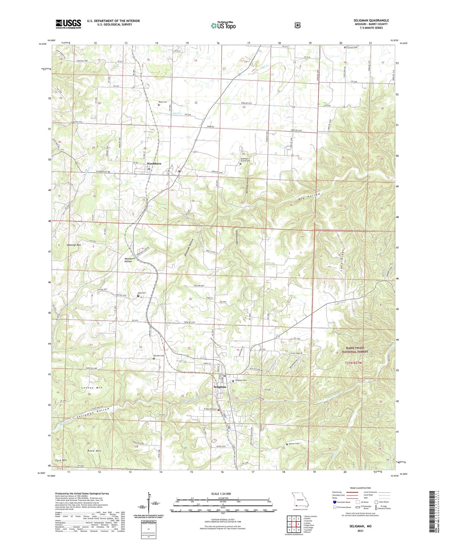
2021 topographic map quadrangle Seligman in the state of Missouri. Scale: 1:24000. Based on the newly updated USGS 7.5' US Topo map series, this map is in the following counties: Barry. The map contains contour data, water features, and other items you are used to seeing on USGS maps, but also has updated roads and other features. This is the next generation of topographic maps. Printed on high-quality waterproof paper with UV fade-resistant inks.
Quads adjacent to this one:
West: Jacket
Northwest: Rocky Comfort
North: Exeter
Northeast: Cassville
East: Eagle Rock
Southeast: Beaver
South: Garfield
Southwest: Pea Ridge
This map covers the same area as the classic USGS quad with code o36093e8.
Contains the following named places: Beaver Cemetery, Beaver Creek, Big Spring Church, Blockade Hollow, Burnett Cemetery, City of Seligman, City of Washburn, Corinth Cemetery, Corinth Church, Ford Mountain, King Cemetery, Lennox Mountain, Lone Star School, Long Ridge, Pender Switch, Reed Mountain, Riley Cemetery, Rock Springs Church, Rock Springs School, Salem Church, Salem Hollow, Seligman, Seligman Cemetery, Seligman Fire Protection District, Seligman Post Office, Southwest Elementary School, Southwest High School, Southwest Middle School, Sparkman Hollow, Sunnyside School, Township of Sugar Creek, Township of Washburn, Twin Spring School, Twin Springs Church, Washburn, Washburn Fire Department Station 1 Headquarters, Washburn Prairie Cemetery, Washburn Prairie Church, Washburn Prairie School, Washburn School, ZIP Code: 65745