MyTopo
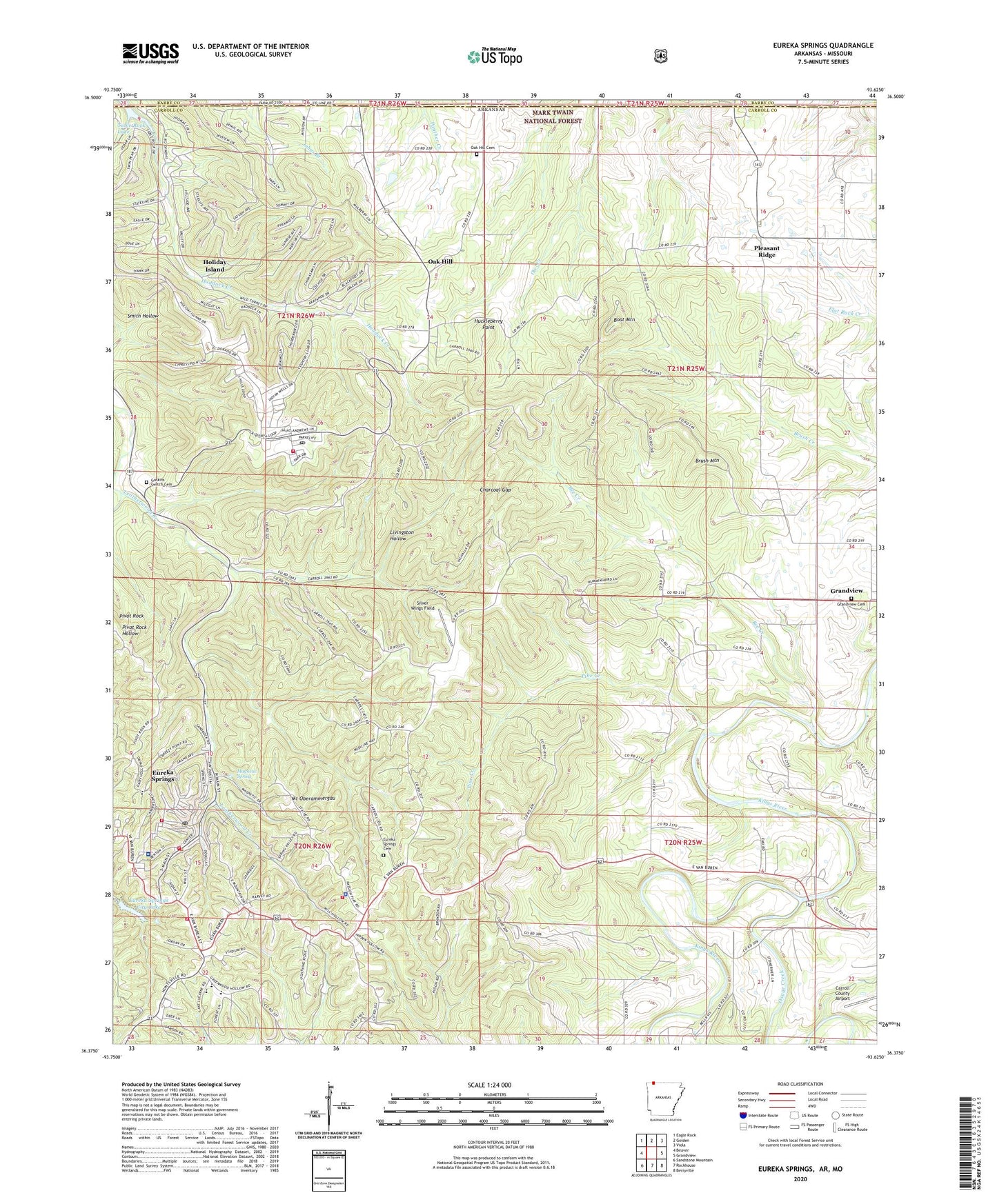
Eureka Springs Arkansas US Topo Map
Couldn't load pickup availability
Also explore the Eureka Springs Forest Service Topo of this same quad for updated USFS data
2024 topographic map quadrangle Eureka Springs in the state of Arkansas. Scale: 1:24000. Based on the newly updated USGS 7.5' US Topo map series, this map is in the following counties: Carroll, Barry. The map contains contour data, water features, and other items you are used to seeing on USGS maps, but also has updated roads and other features. This is the next generation of topographic maps. Printed on high-quality waterproof paper with UV fade-resistant inks.
Quads adjacent to this one:
West: Beaver
Northwest: Eagle Rock
North: Golden
Northeast: Viola
East: Grandview
Southeast: Berryville
South: Rockhouse
Southwest: Sandstone Mountain
Contains the following named places: Bee Creek, Boat Mountain, Brush Mountain, Charcoal Gap, Christ of the Ozarks, Church of Christ, City of Eureka Springs, Eureka Springs, Eureka Springs Cemetery, Eureka Springs City Lake, Eureka Springs City Lake Dam, Eureka Springs Elementary School, Eureka Springs Fire Department Ambulance, Eureka Springs Fire Department Station 1, Eureka Springs Fire Department Station 2, Eureka Springs Fire Department Station 3, Eureka Springs Fire Department Station 4, Eureka Springs High School, Eureka Springs Historic District, Eureka Springs Hospital, Eureka Springs Middle School, Eureka Springs Police Department, Eureka Springs Post Office, First Presbyterian Church, Freewill Church, Gaskins, Gaskins Switch Cemetery, Grandview Cemetery, Haddock Creek, Hammond Bell Museum, Harmon Park, Harps Doll Museum, Holiday Island, Holiday Island Census Designated Place, Holiday Island Post Office, Holiday Island Volunteer Fire Department Station 2, Huckleberry Point, Junction, KTCN-FM (Eureka Springs), Livingston Hollow, Magnetic Spring, Mount Oberammergau, Oak Hill, Oak Hill Cemetery, Oak Hill School, Osage Creek, Pine Creek, Pivot Rock, Pleasant Ridge, Rock Springs Baptist Church, Rock Springs School, Saint Elizabeth Catholic Church, Silver Wings Field, Town of Holiday Island, Township of Cross, Township of Franklin, Township of Kings River, Tunnel, West Leatherwood Creek