MyTopo
Ellsinore Missouri US Topo Map
Couldn't load pickup availability
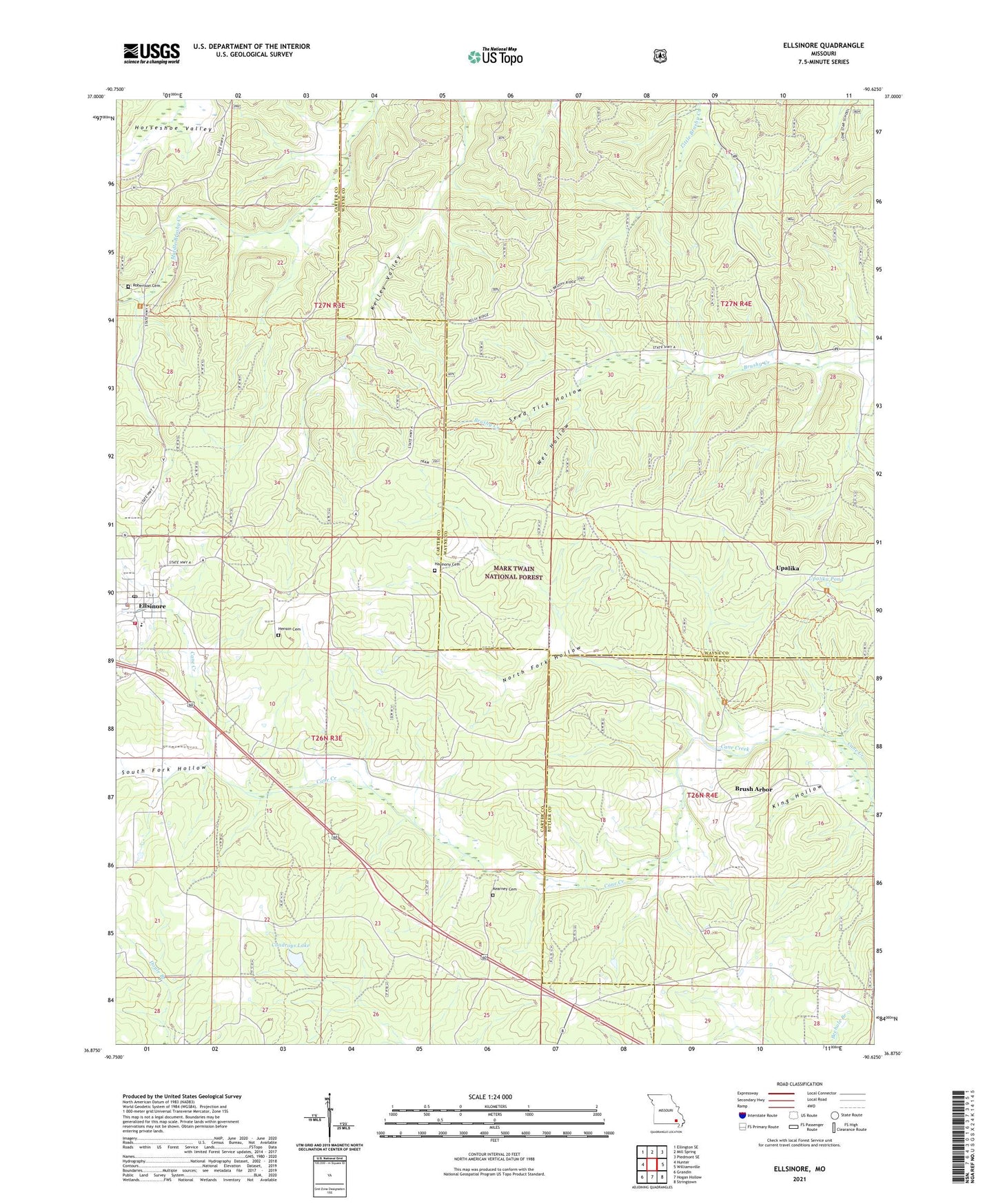
2021 topographic map quadrangle Ellsinore in the state of Missouri. Scale: 1:24000. Based on the newly updated USGS 7.5' US Topo map series, this map is in the following counties: Carter, Wayne, Butler. The map contains contour data, water features, and other items you are used to seeing on USGS maps, but also has updated roads and other features. This is the next generation of topographic maps. Printed on high-quality waterproof paper with UV fade-resistant inks.
Quads adjacent to this one:
West: Hunter
Northwest: Ellington SE
North: Mill Spring
Northeast: Piedmont SE
East: Williamsville
Southeast: Stringtown
South: Hogan Hollow
Southwest: Grandin
Contains the following named places: Brush Arbor, Brush Arbor Community Center, CCC Camp, Chapel Hill Church, Chapel Hill School, City of Ellsinore, Commertown School, Condroys Lake, Crommertown School, Ellsinore, Ellsinore Police Department, Ellsinore Post Office, Ellsinore Rural Fire Protection District, Freeland School, Harmony Cemetery, Harmony General Baptist Church, Henson Cemetery, Hill Top, Hilladay, Kearney Cemetery, King Hollow, Lakeview Tree Farm Dam, North Fork Hollow, Orchard Switch, Pond, Robertson Cemetery, Seed Tick Hollow, South Fork Hollow, Union Hill Church, Upalika, Upalika Pond, Walton Chapel, Walton School, Wet Hollow