MyTopo
Farber Missouri US Topo Map
Couldn't load pickup availability
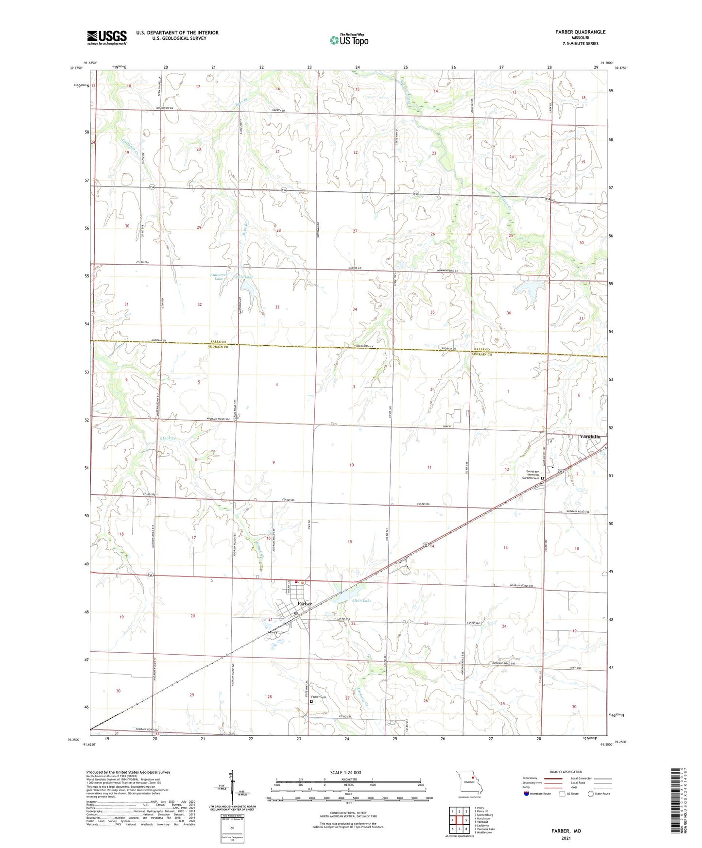
2021 topographic map quadrangle Farber in the state of Missouri. Scale: 1:24000. Based on the newly updated USGS 7.5' US Topo map series, this map is in the following counties: Audrain, Ralls. The map contains contour data, water features, and other items you are used to seeing on USGS maps, but also has updated roads and other features. This is the next generation of topographic maps. Printed on high-quality waterproof paper with UV fade-resistant inks.
Quads adjacent to this one:
West: Hutchison
Northwest: Perry
North: Perry NE
Northeast: Spencerburg
East: Vandalia
Southeast: Middletown
South: Vandalia Lake
Southwest: Laddonia
Contains the following named places: Alton Lake, Alton Lake Dam, Auwarter Lake, Bear Branch School, Buell Airport, Carl Moore Lake Dam, Carlson Lake Dam, City of Farber, Eisele Lake, Eisele Lake Dam, Evergreen Memorial Gardens Cemetery, Farber, Farber Cemetery, Farber Post Office, Farber Volunteer Fire Department, Gibson Dam, Liberty Hall, Nadine, Nadine School, Number 572 Dam, Robinson Lake Dam, Van-Far Elementary School, Van-Far High School, Verna Moore Dam, ZIP Code: 63345