MyTopo
Hutchison Missouri US Topo Map
Couldn't load pickup availability
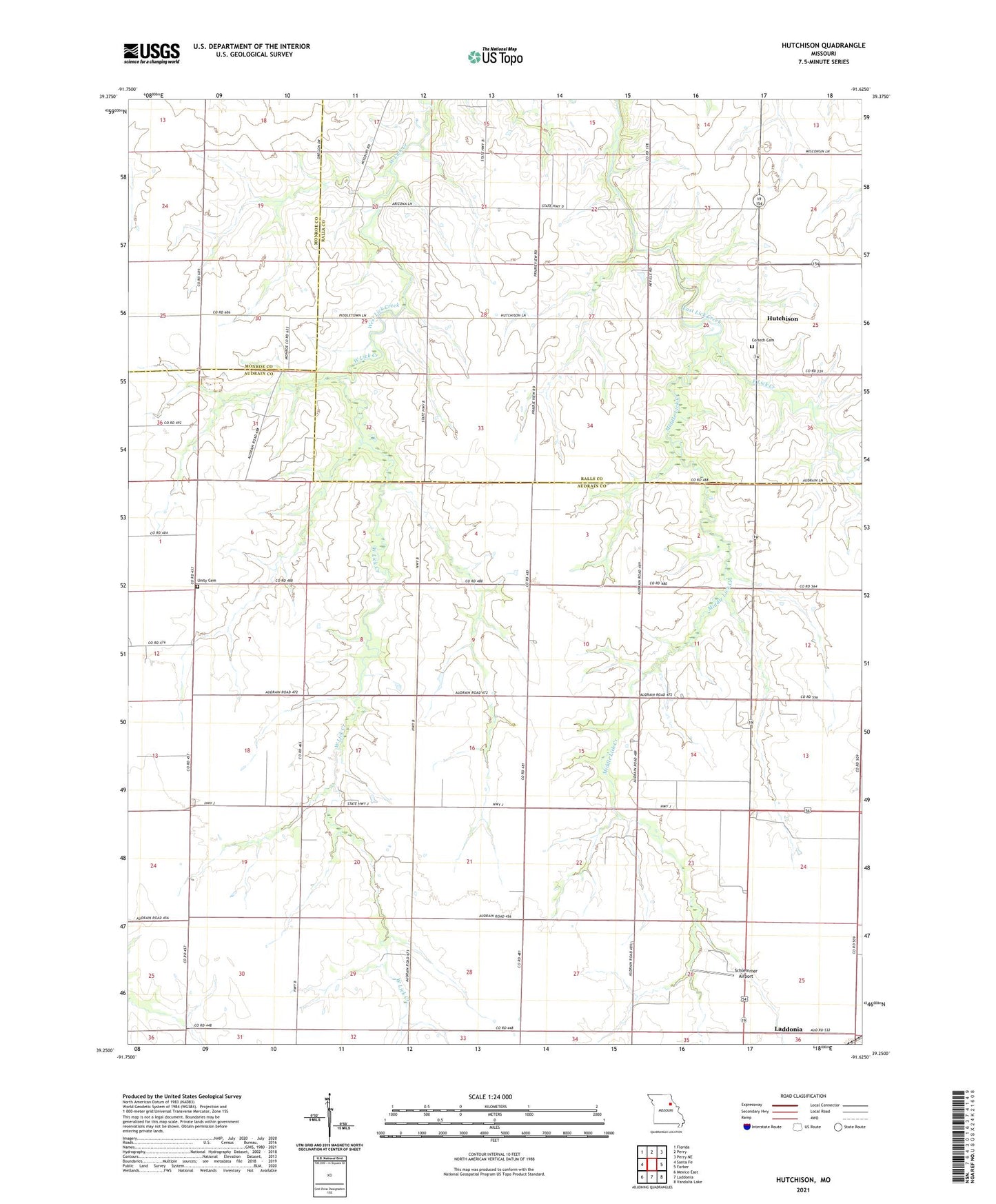
2021 topographic map quadrangle Hutchison in the state of Missouri. Scale: 1:24000. Based on the newly updated USGS 7.5' US Topo map series, this map is in the following counties: Audrain, Ralls, Monroe. The map contains contour data, water features, and other items you are used to seeing on USGS maps, but also has updated roads and other features. This is the next generation of topographic maps. Printed on high-quality waterproof paper with UV fade-resistant inks.
Quads adjacent to this one:
West: Santa Fe
Northwest: Florida
North: Perry
Northeast: Perry NE
East: Farber
Southeast: Vandalia Lake
South: Laddonia
Southwest: Mexico East
This map covers the same area as the classic USGS quad with code o39091c6.
Contains the following named places: Bassinger Corner, Black Lake Dam, Corinth Cemetery, Elm Bend School, Hutchison, Hutchison School, McClintic School, Middle Lick Creek, Neville School, Oak Grove School, Peery Lake Dam, Piddletown School, Pound Lake Dam, Prairie View Church, Schlemmer Airport, Township of Prairie, Unity Cemetery, West Lick School