MyTopo
Laddonia Missouri US Topo Map
Couldn't load pickup availability
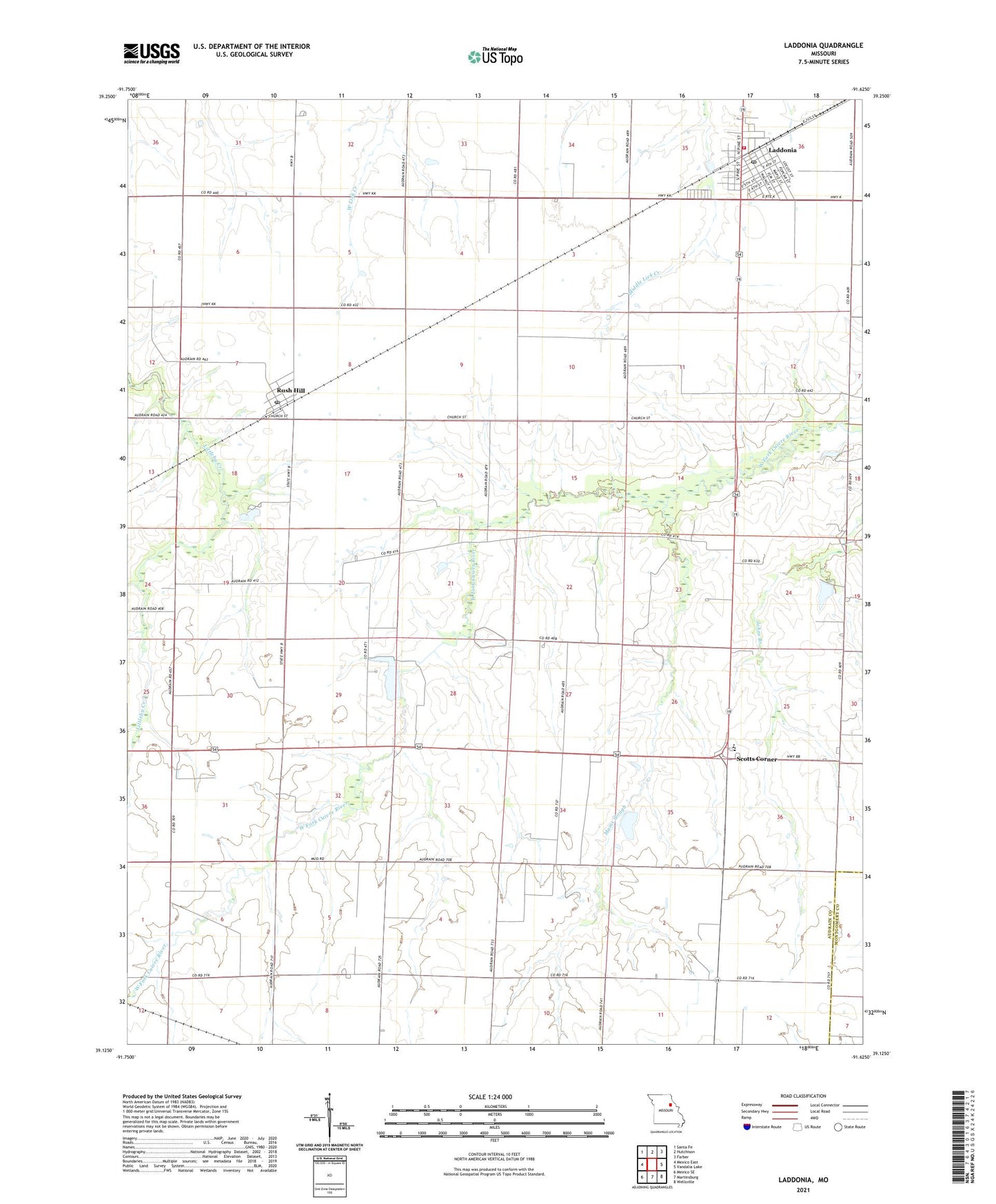
2021 topographic map quadrangle Laddonia in the state of Missouri. Scale: 1:24000. Based on the newly updated USGS 7.5' US Topo map series, this map is in the following counties: Audrain, Montgomery. The map contains contour data, water features, and other items you are used to seeing on USGS maps, but also has updated roads and other features. This is the next generation of topographic maps. Printed on high-quality waterproof paper with UV fade-resistant inks.
Quads adjacent to this one:
West: Mexico East
Northwest: Santa Fe
North: Hutchison
Northeast: Farber
East: Vandalia Lake
Southeast: Wellsville
South: Martinsburg
Southwest: Mexico SE
This map covers the same area as the classic USGS quad with code o39091b6.
Contains the following named places: Boonslick Planning Region, Cauthorn School, City of Laddonia, Community R-VI Elementary School, Community R-VI High School, Deimeke Lake Dam, Edwards School, Eureka School, Fennewald School, Freyer Lake Dam, Freyer Lake East Dam, Laddonia, Laddonia Post Office, Laddonia Rural Fire Protection Association, Mams Slough, Prairie Chapel School, Riechers Lake Dam, Rush Hill, Rush Hill Post Office, Scotts Corner, Township of Linn, Village of Rush Hill, Walker School, ZIP Codes: 63352, 65280