MyTopo
Fremont Missouri US Topo Map
Couldn't load pickup availability
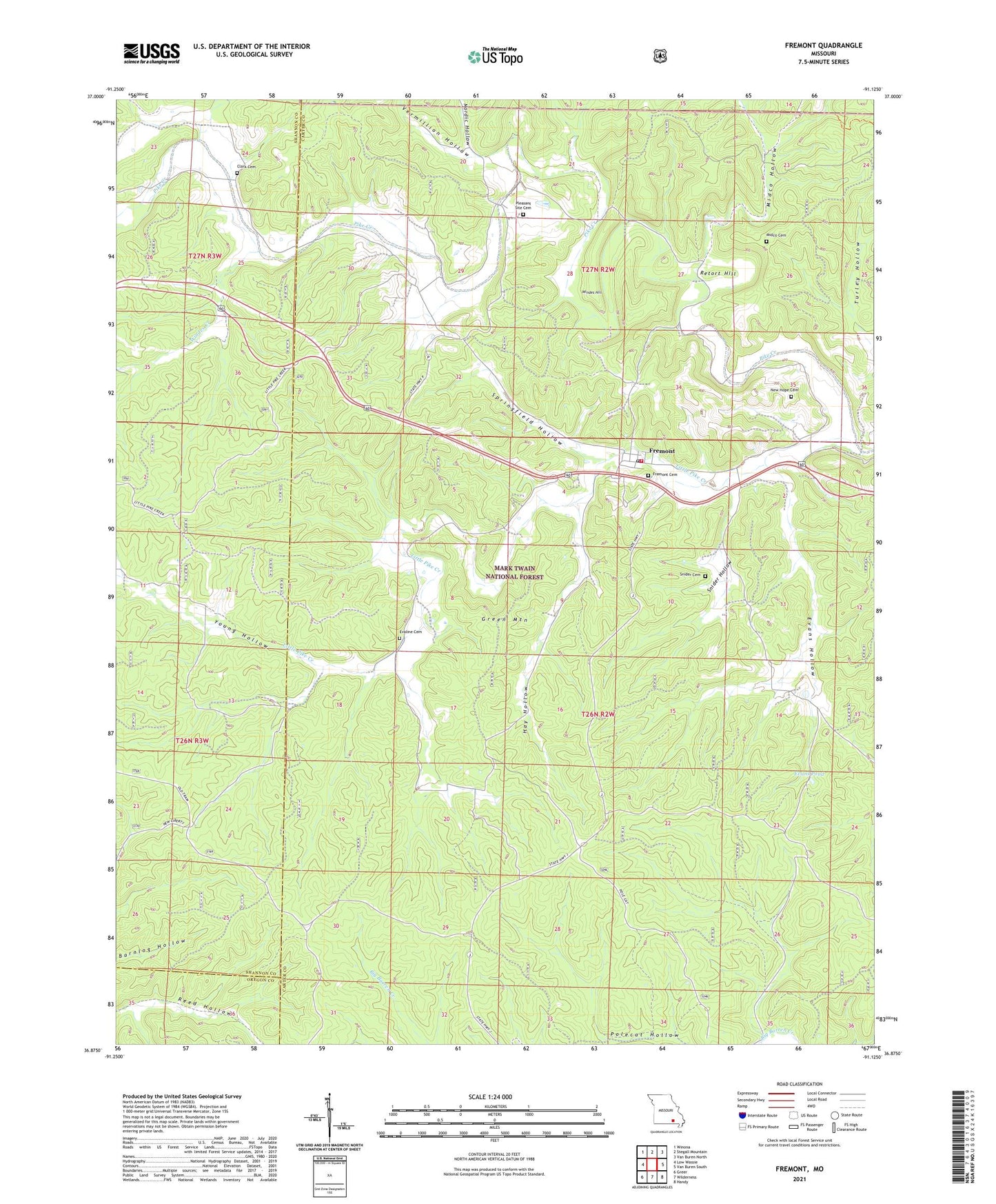
2021 topographic map quadrangle Fremont in the state of Missouri. Scale: 1:24000. Based on the newly updated USGS 7.5' US Topo map series, this map is in the following counties: Carter, Shannon, Oregon. The map contains contour data, water features, and other items you are used to seeing on USGS maps, but also has updated roads and other features. This is the next generation of topographic maps. Printed on high-quality waterproof paper with UV fade-resistant inks.
Quads adjacent to this one:
West: Low Wassie
Northwest: Winona
North: Stegall Mountain
Northeast: Van Buren North
East: Van Buren South
Southeast: Handy
South: Wilderness
Southwest: Greer
Contains the following named places: Clark Cemetery, Curve Bridge Picnic Area, Dry Fork, Evaline Cemetery, Evans Hollow, Evans Pond, Fremont, Fremont Census Designated Place, Fremont Fire Protection District, Fremont Lookout Tower, Fremont Picnic Area, Fremont Post Office, Fremont Tower Picnic Area, Green Mountain, Hay Hollow, Little Pike Creek, Midco Cemetery, Midco Hollow, New Hope Cemetery, Nordic Hollow, Pleasant Site Cemetery, Pleasant Site School, Retort Hill, Site of Old Midco Iron Works, Snider Cemetery, Snider Hollow, Springfield Hollow, Township of Pike, Vermillion Hollow, Windes Creek, Windes Hill, Young Hollow, ZIP Code: 63941