MyTopo
Galena Missouri US Topo Map
Couldn't load pickup availability
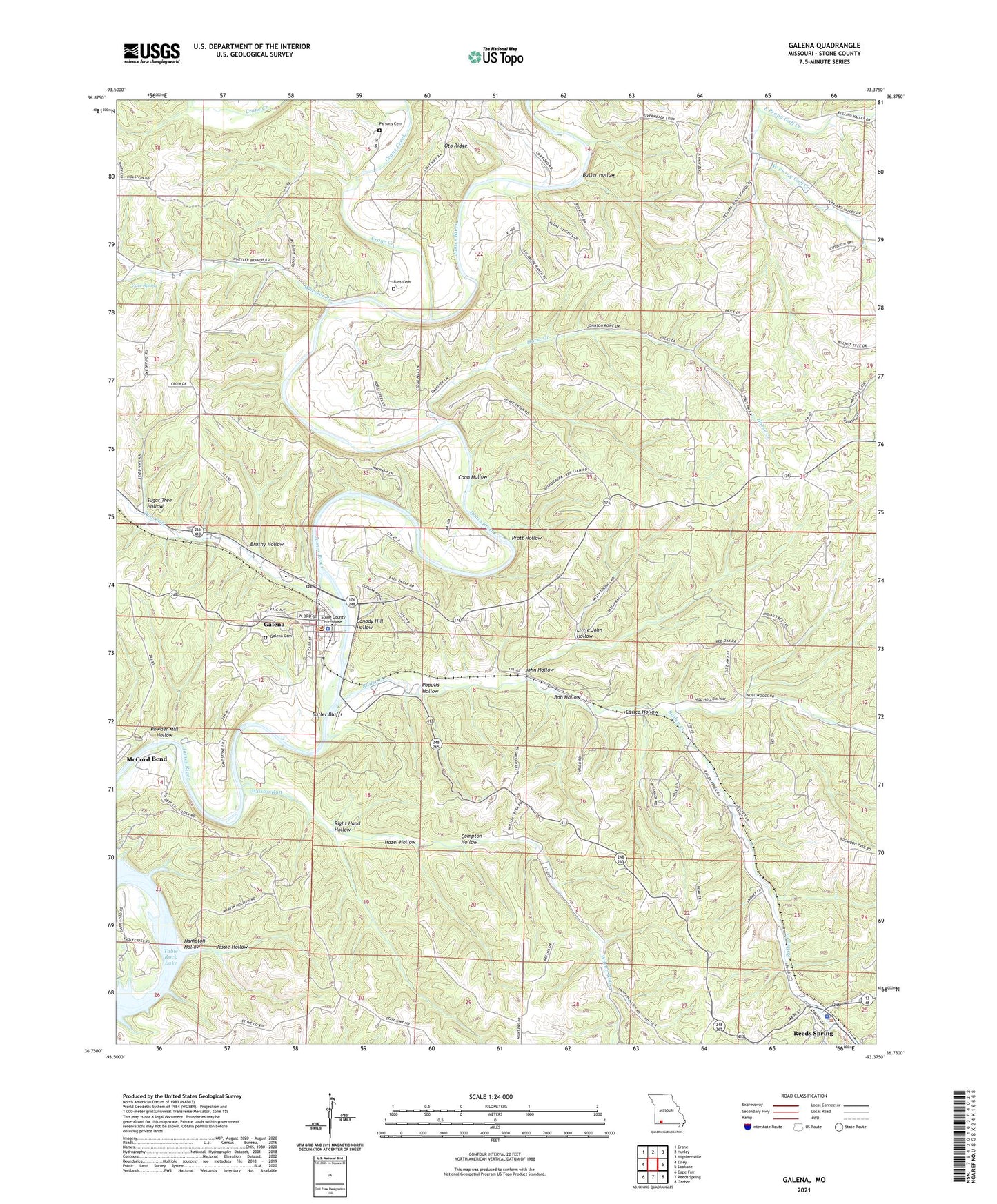
2021 topographic map quadrangle Galena in the state of Missouri. Scale: 1:24000. Based on the newly updated USGS 7.5' US Topo map series, this map is in the following counties: Stone. The map contains contour data, water features, and other items you are used to seeing on USGS maps, but also has updated roads and other features. This is the next generation of topographic maps. Printed on high-quality waterproof paper with UV fade-resistant inks.
Quads adjacent to this one:
West: Elsey
Northwest: Crane
North: Hurley
Northeast: Highlandville
East: Spokane
Southeast: Garber
South: Reeds Spring
Southwest: Cape Fair
Contains the following named places: Arnold Lodge, Bass Cemetery, Bear Den Junction, Bob Hollow, Brushy Hollow, Butler Bluffs, Butler Hollow, Camp Clark, Camp Yocum, Canady Hill Hollow, Carico, Carico Hollow, Carr Ford, Cave Spring, Christian Union Church, City of Galena, Compton Hollow, Coon Hollow, Crane Creek, Cresent School, East Prong Goff Creek, Edgar Camp, Galena, Galena Post Office, Gregg Camp, Hampton Hollow, Hazel Hollow, Horse Creek, Horse Creek School, Jessie Hollow, John Hollow, Limberlost Camp, Little John Hollow, Muehlbach Camp, North Stone Northeast Barry County Fire District Station 21, Oto, Oto Church, Oto School, Parsons Cemetery, Pine Run, Populis Hollow, Powder Mill Hollow, Pratt Hollow, Railey Creek, Railey Creek School, Ramblers Camp, Reeds Spring Police Department, Right Hand Hollow, Stone County Sheriff's Office, Sugar Tree Hollow, Taylor Camp, Township of McKinley, Township of Washington, Watts-Smith Airport, West Prong Goff Creek, Wheeler Branch, Wilson Run, ZIP Code: 65656