MyTopo
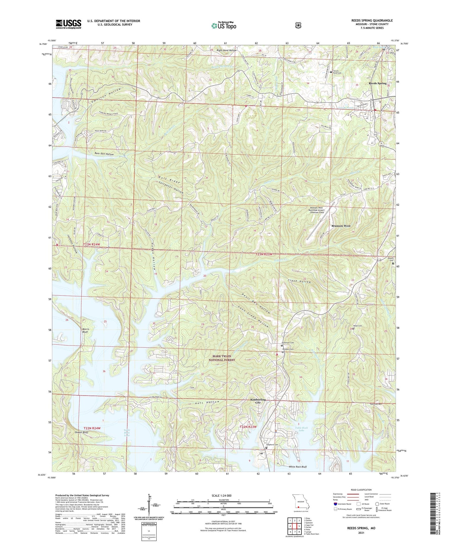
Reeds Spring Missouri US Topo Map
Couldn't load pickup availability
Also explore the Reeds Spring Forest Service Topo of this same quad for updated USFS data
2021 topographic map quadrangle Reeds Spring in the state of Missouri. Scale: 1:24000. Based on the newly updated USGS 7.5' US Topo map series, this map is in the following counties: Stone. The map contains contour data, water features, and other items you are used to seeing on USGS maps, but also has updated roads and other features. This is the next generation of topographic maps. Printed on high-quality waterproof paper with UV fade-resistant inks.
Quads adjacent to this one:
West: Cape Fair
Northwest: Elsey
North: Galena
Northeast: Spokane
East: Garber
Southeast: Table Rock Dam
South: Lampe
Southwest: Viola
This map covers the same area as the classic USGS quad with code o36093f4.
Contains the following named places: Allen Church, Ance Creek School, Aunts Creek, Aunts Creek Park, Aunts Creek Public Use Area, Aurora Club, Bear Den Creek, Bear Den Hollow, Bearden Camp, Branson West Municipal Airport - Emerson Field, City of Branson West, City of Kimberling City, City of Reeds Spring, Coon Creek Hollow, Crane Hollow, Creller Camp, Devil Den Hollow, Emerson Airport, Emerson Hollow, Fisher Creek Country Club, Hideaway Marina, Highway Thirteen Park, Highway Thirteen Public Use Area, Hodge Hollow, Holt Hollow, Jackson Hollow, Kimberling City, Kimberling City Area Community Center, Kimberling City Police Department, Kimberling City Post Office, Little Aunts Creek, Maranatha Church, Mead Cemetery, Morris Bluff, Nickerson Cemetery, Omar Gibson Vocational-Technical School, Oswalt Bluff, Oswalt Cemetery, Peach Orchard Creek, Philibert Cemetery, Powell Cemetery, Reeds Spring, Reeds Spring High School, Reeds Spring Post Office, Reeds Spring School, Rock Church, Saltpeter Hollow, Schooner School, Shepherd Cemetery, South Aunts Creek, Southern Stone County Fire Protection District Station 11, Southern Stone County Fire Protection District Station 2, Southern Stone County Fire Protection District Station 6, Southern Stone County Fire Protection District Station 7, Sow Coon Mountain, Stallion School, Stone County, Stoneridge, Thelma, Township of Ruth A, Township of Ruth B, Township of Ruth B City, Township of Ruth B Rural, View, Waldo Powell Roadside Park, West Fisher Creek, White Rock Bluff, Wolf Ridge, Yocum Pond, Yocum Pond Cemetery, Yocum Pond Church, ZIP Code: 65686