MyTopo
Gasconade Missouri US Topo Map
Couldn't load pickup availability
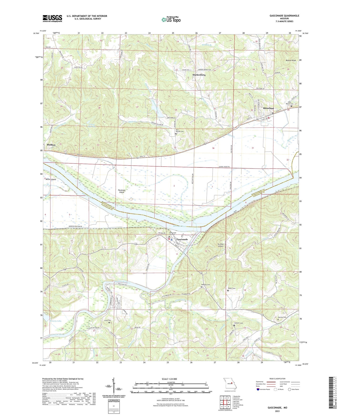
2021 topographic map quadrangle Gasconade in the state of Missouri. Scale: 1:24000. Based on the newly updated USGS 7.5' US Topo map series, this map is in the following counties: Montgomery, Gasconade. The map contains contour data, water features, and other items you are used to seeing on USGS maps, but also has updated roads and other features. This is the next generation of topographic maps. Printed on high-quality waterproof paper with UV fade-resistant inks.
Quads adjacent to this one:
West: Morrison
Northwest: Readsville
North: Americus
Northeast: Pinnacle Lake
East: Hermann
Southeast: Swiss
South: Pershing
Southwest: Fredericksburg
Contains the following named places: Baileys Creek, Best Bottom Cemetery, Best Bottom School, Bluffton, Boland Knob, Brushy Fork, City of Gasconade, Doecher Cemetery, Eu-Wish Airport, First Creek, Gasconade, Gasconade City Cemetery, Gasconade River, Gasconnade Police Department, Gleason Branch, Government Boat Yard, Heckman Island, Howard Creek, Libbie Branch, Lower First Creek School, Lucas Cemetery, Memory Lake, Memory Lake Dam, Modoc Creek, Morrison Volunteer Fire Department Station 2, Oetterer Cemetery, O'Neal Dam One, O'Neal Lake One, Rabenau Cemetery, Rhineland, Rhineland Area Volunteer Fire Department, Rhineland Post Office, River Park, Saint Marcus Cemetery, Starkenburg, Stolpe, Stolpe Census Designated Place, Sugar Creek, Town of Rhineland, Township of Richland, W Grimm Dam, W Grimm Reservoir, Weber Cemetery, Wyatt Lake Dam