MyTopo
Morrison Missouri US Topo Map
Couldn't load pickup availability
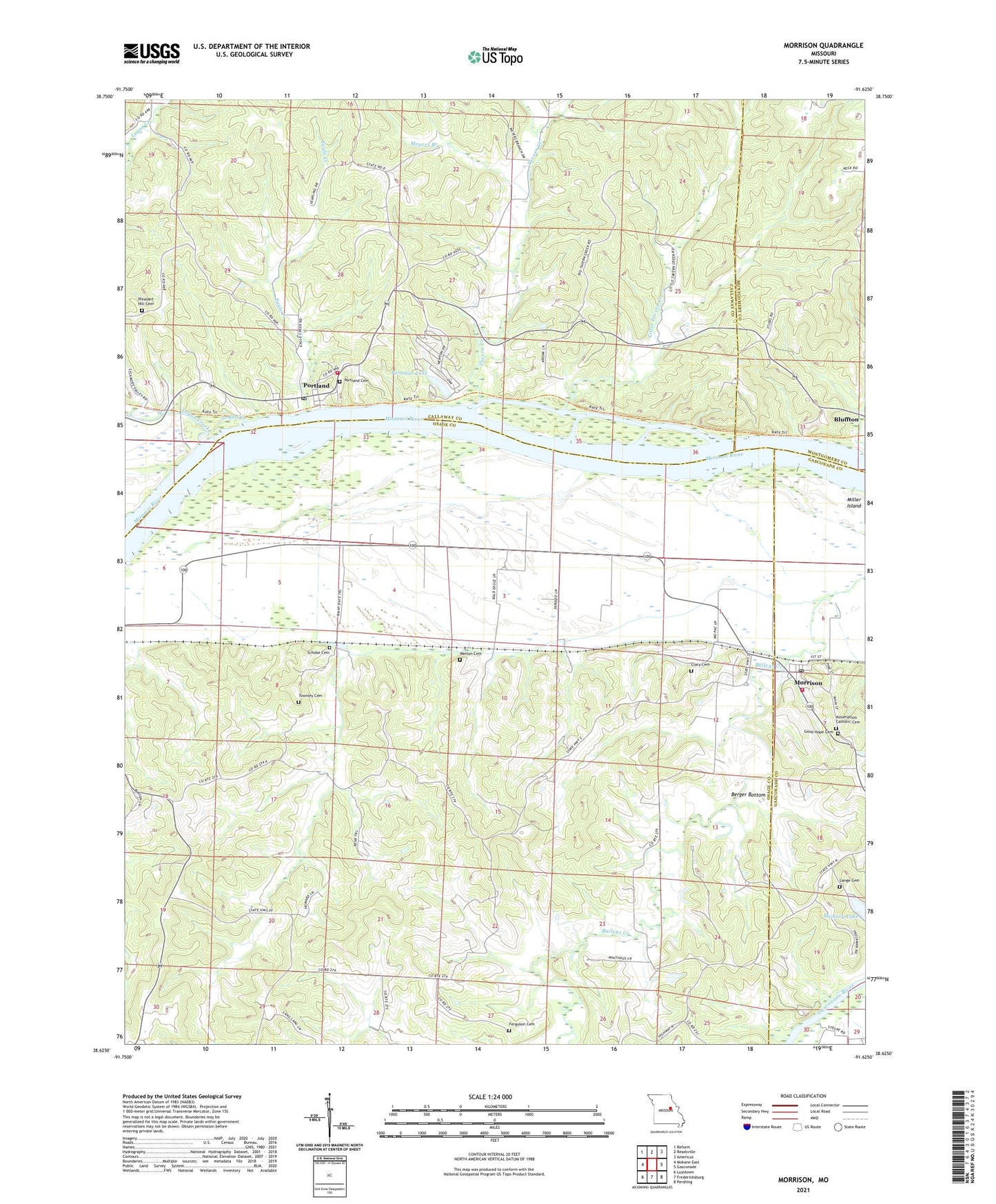
2021 topographic map quadrangle Morrison in the state of Missouri. Scale: 1:24000. Based on the newly updated USGS 7.5' US Topo map series, this map is in the following counties: Osage, Callaway, Gasconade, Montgomery. The map contains contour data, water features, and other items you are used to seeing on USGS maps, but also has updated roads and other features. This is the next generation of topographic maps. Printed on high-quality waterproof paper with UV fade-resistant inks.
Quads adjacent to this one:
West: Mokane East
Northwest: Reform
North: Readsville
Northeast: Americus
East: Gasconade
Southeast: Pershing
South: Fredericksburg
Southwest: Luystown
This map covers the same area as the classic USGS quad with code o38091f6.
Contains the following named places: Adolph, Baker Dam, Baker Lake, Berger Bottom, Busse School, City of Morrison, Clary Cemetery, Dodd School, Eagle Creek, Ferguson Cemetery, Gibson School, Good Hope Cemetery, Heilburn, King School, Lange Cemetery, Lange School, Little Tavern Creek, Logan Creek, Meramec Planning Region, Meyers Branch, Miller Island, Mollie Dozier Chute, Morrison, Morrison Post Office, Morrison Volunteer Fire Department Headquarters, Paradise Lake, Paradise Lake Dam, Pleasant Hill Church, Portage, Portland, Portland Post Office, Portland School, Rost School, Schobe Cemetery, Shawnee Creek, Shawnee Creek Church, Shawnee Creek School, Shobes Branch, South Callaway Fire Protection District Station 3, Starke School, Synthianna Creek, Tavern Creek, Tavern Hill School, Townley Cemetery, Township of Benton, Welton Cemetery