MyTopo
Americus Missouri US Topo Map
Couldn't load pickup availability
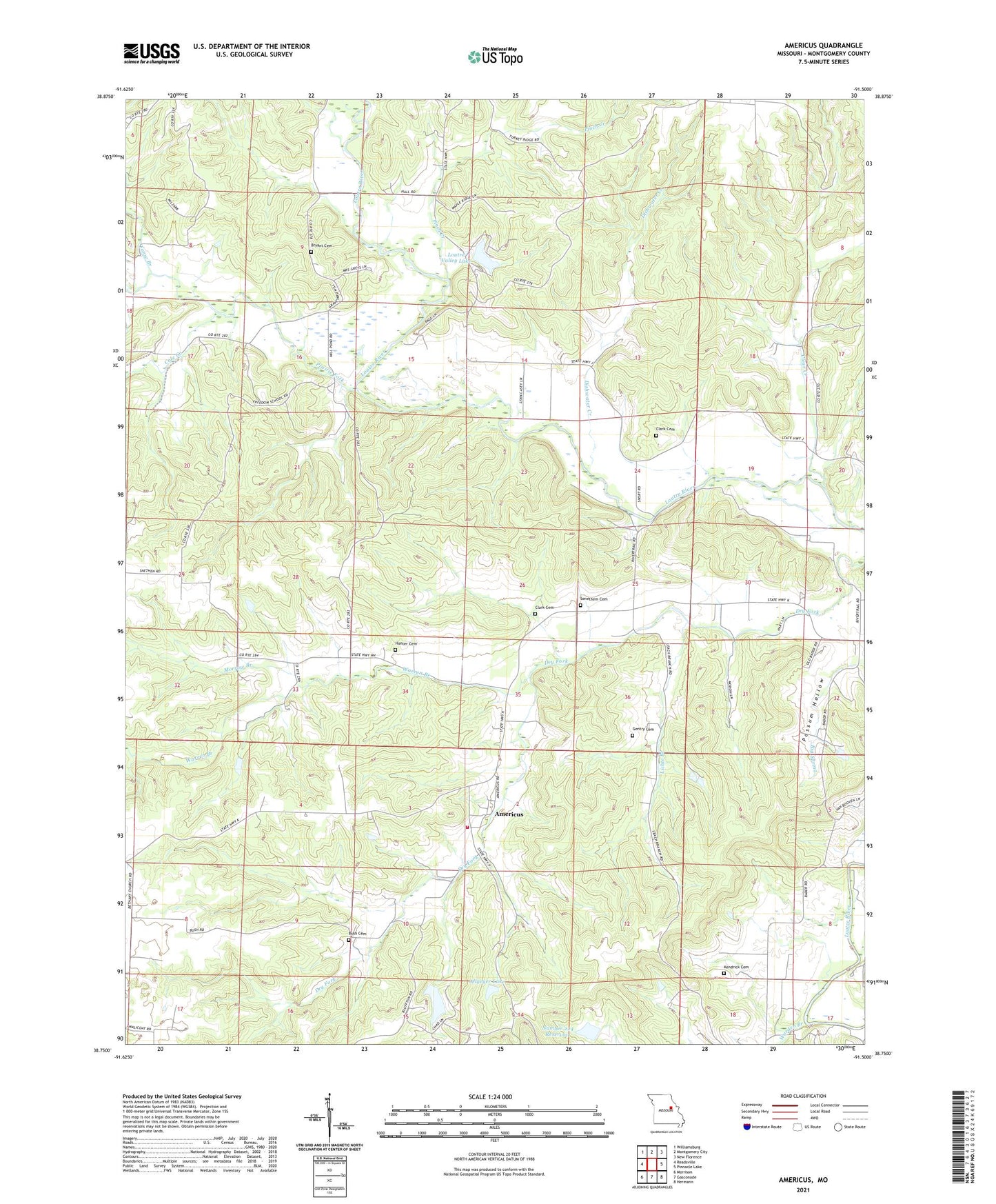
2021 topographic map quadrangle Americus in the state of Missouri. Scale: 1:24000. Based on the newly updated USGS 7.5' US Topo map series, this map is in the following counties: Montgomery. The map contains contour data, water features, and other items you are used to seeing on USGS maps, but also has updated roads and other features. This is the next generation of topographic maps. Printed on high-quality waterproof paper with UV fade-resistant inks.
Quads adjacent to this one:
West: Readsville
Northwest: Williamsburg
North: Montgomery City
Northeast: New Florence
East: Pinnacle Lake
Southeast: Hermann
South: Gasconade
Southwest: Morrison
This map covers the same area as the classic USGS quad with code o38091g5.
Contains the following named places: Allgeyer Lake, Allgeyer Lake Dam, Americus, Big Spring Fire Protection District Station 2, Big Spring R-1 School, Bridge School, Bryant Cemetery, Bush Cemetery, Clark Cemetery, Clear Creek, Cole Creek, Danville State Wildlife Area, Delgman Lake, Delgman Lake Dam, Dishwater Creek, Fairview School, Fonso Branch, Freedom School, Gentry Cemetery, Hart School, Henry Lake Dam, Hunter Cemetery, Kendrick Cemetery, Kendrick School, Kenny Lake Dam, Lichte Branch, Loutre, Loutre Lick Access Area, Loutre Post Office, Loutre Valley Dam, Loutre Valley Lake, Loutre Valley School, Milzark Dam, Milzark Lake, Morrow Branch, Munzlinger Lake Dam, Number 224 Reservoir, Pinch Creek, Possum Hollow, Prairie Fork, Prairie Fork School, Senethem Cemetery, Simpson Branch, Thornhill and Schulz State Wildlife Area, Township of Loutre, Warden Branch, Warren Branch, Whiteside School, ZIP Code: 65069