MyTopo
Fredericksburg Missouri US Topo Map
Couldn't load pickup availability
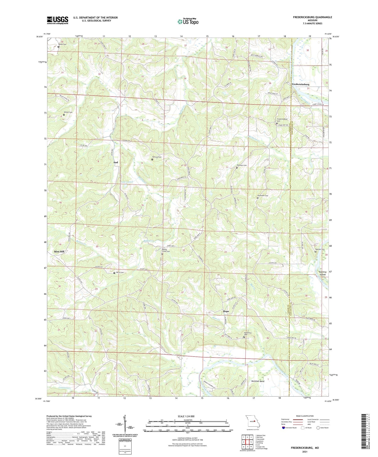
2021 topographic map quadrangle Fredericksburg in the state of Missouri. Scale: 1:24000. Based on the newly updated USGS 7.5' US Topo map series, this map is in the following counties: Osage, Gasconade. The map contains contour data, water features, and other items you are used to seeing on USGS maps, but also has updated roads and other features. This is the next generation of topographic maps. Printed on high-quality waterproof paper with UV fade-resistant inks.
Quads adjacent to this one:
West: Luystown
Northwest: Mokane East
North: Morrison
Northeast: Gasconade
East: Pershing
Southeast: Goerlisch Ridge
South: Cooper Hill
Southwest: Linn
This map covers the same area as the classic USGS quad with code o38091e6.
Contains the following named places: Aud, Baecker Cemetery, Bailey Creek Catholic Church, Baileys Creek Cemetery, Evangical Church, Fredericksburg, Fredericksburg Church, Hancock Cemetery, Harris Cemetery, Heckman Bend, Hope, Hope Creek, Karschnick Cemetery, Koelling Islands, Lake Isabell, Lake Isabell Dam, Lay High School, Liberty School, Mint Hill, Mint Hill Post Office, Mud Creek School, Oklahoma Church, Oshawa, Plattners Cemetery, Plattners School, Richland Creek, Salem Church, Salem Presbyterian Church, Southwest Cemetery, Southwest Church, Welcome, Wilhoit Cemetery, Wittenbach School, Woods Cemetery, ZIP Codes: 65061, 65062