MyTopo
Owensville East Missouri US Topo Map
Couldn't load pickup availability
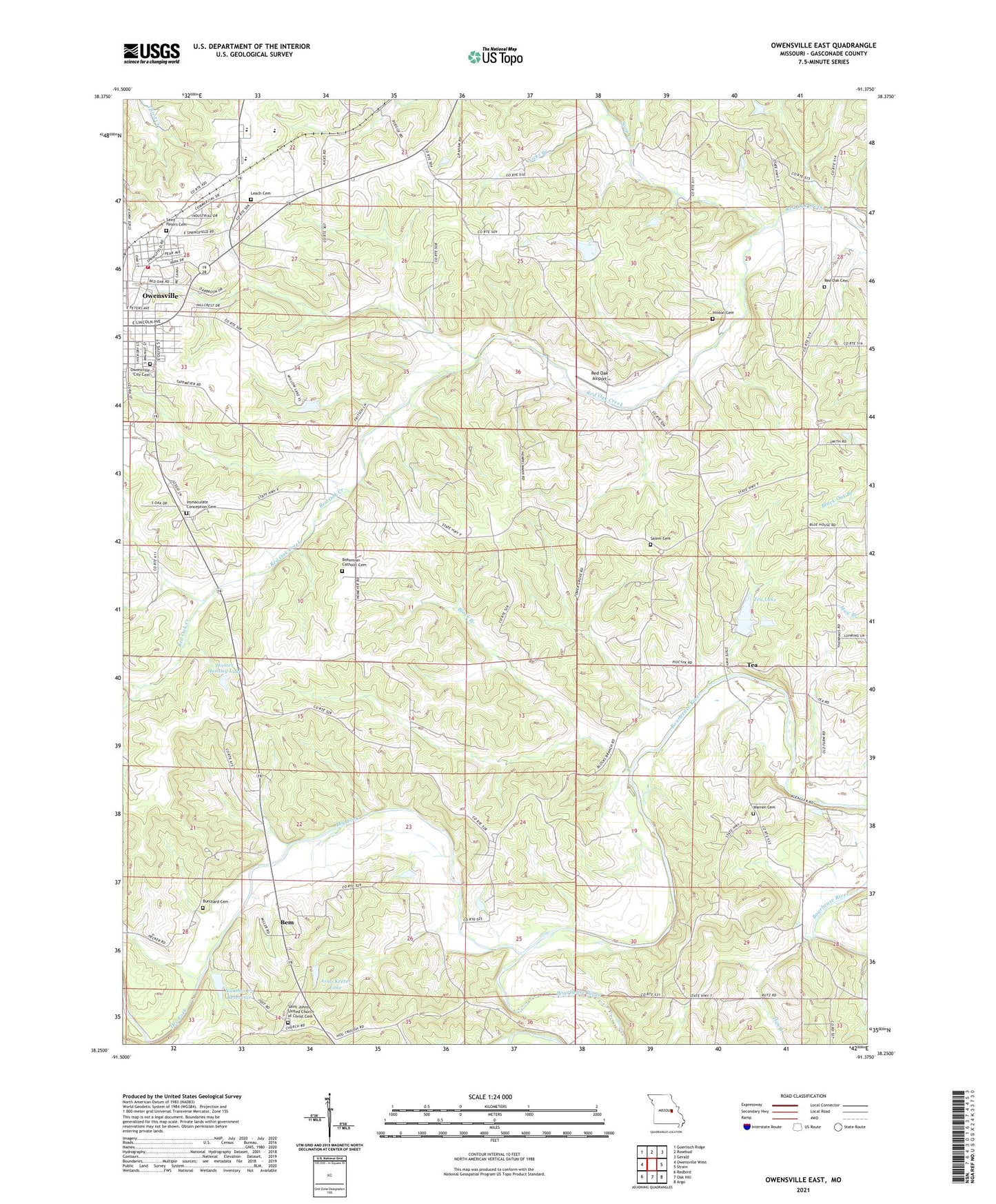
2021 topographic map quadrangle Owensville East in the state of Missouri. Scale: 1:24000. Based on the newly updated USGS 7.5' US Topo map series, this map is in the following counties: Gasconade. The map contains contour data, water features, and other items you are used to seeing on USGS maps, but also has updated roads and other features. This is the next generation of topographic maps. Printed on high-quality waterproof paper with UV fade-resistant inks.
Quads adjacent to this one:
West: Owensville West
Northwest: Goerlisch Ridge
North: Rosebud
Northeast: Gerald
East: Strain
Southeast: Argo
South: Oak Hill
Southwest: Redbird
This map covers the same area as the classic USGS quad with code o38091c4.
Contains the following named places: Arno Kreter Lake, Bains Lake Dam, Bay Lake Dam, Bem, Block Branch, Burchard Cemetery, Burchard School, City of Owensville, Dan Branch, Dry Fork, Hensley Lake Dam, Hinton Cemetery, Hinton School, Homer Hensley Lake, Immaculate Conception Cemetery, Juedman School, Kehr Lake Dam, Landwehr Lake Dam, Leach Cemetery, Lions Park, Mistler Lake Dam, Morgan School, Mueller Lake Dam, Nicks Branch, Number 72 Reservoir, Number 74 Lake, Oak Grove School, Owensville City Cemetery, Owensville High School, Owensville Junior High School, Owensville Volunteer Fire Department Station 3, Pentacost Church, Raack Lake Dam, Red Oak Airport, Red Oak Church, Saint Johns Church, Saint Peters Cemetery, Salem Cemetery, Salem Church, Soap Creek, Tayloe Lake Dam East, Tayloe Lake Dam West, Tayloe School, Tea, Tea Lake, Tea Lake Dam Number 2, Tea Lakes, Tea Lakes Dam Number 1, Tea School, Township of Brush Creek, Township of Canaan, Wagner Lake Dam, Warren Church, ZIP Codes: 63091, 65066